OpenMadeira
Tell me about the Caniço Levada Trail (Camacha) levada walk in Madeira
💭 Thinking
The user is asking about the Caniço Levada Trail (Camacha) levada walk in Madeira. Let me search for this trail in ourhikes database.The search returned no results. Let me try a broader search - the trail might be listed under a different name. Let me try "Levada do Caniço" or just search nearCamacha.The user asked about the "Caniço Levada Trail (Camacha)". I found it in the community_trails section of the results. Let me compile the relevant information. Key details: - Name: Caniço Levada Trail (Camacha) - It's a community/unofficial trail, NOT part of Madeira's official PR trail network managed by IFCN - Difficulty: hard - Length: 11.7 km - Route type: out and back - Estimated time: 5–5.5 hr - Rating: 3.7★ from 36 reviews on AllTrails - Description: "IMPORTANT: After a heavy downpour, do not attempt this walk. The levada could overflow onto the path and make it impossible to cross. This lovely route begins and ends in the charming village of Camacha, located in the municipality of Santa Cruz. It invites you to walk along part of the Levada do Caniço, which starts in the center of Camacha and stretches up to the highest areas of Caniço." - Coordinates: 32.67898, -16.84456 - Directions URL: https://www.google.com/maps/dir/?api=1&destination=32.678980,-16.844560 - AllTrails URL: https://www.alltrails.com/trail/portugal/madeira--2/trilho-da-levada-do-canico-camacha - Notice: Community route mapped on AllTrails — NOT part of Madeira's official PR trail network managed by IFCN There's also a related trail called "Levada do Caniço" (8.7 km, moderate, 4.2★, 71 reviews) which is shorter and covers part of the same levada. Let me also note the nearby official PR trails for context. The closest ones are some distance away (PR 3.1, PR 4, PR 10, PR 11, PR 3). I should present this clearly, noting it's an unofficial community trail, and mention the safety warning about heavy rain andoverflow.
How this was derived · 1 step
Trails near CamachaMap & photos
6 photos
Caminho Real do MonteCaminho Real do MonteCaminho Real do MonteCaminho Real do MonteCaminho Real do MonteCaminho Real do Monte
Official PR trail (IFCN) Community route (AllTrails — not official)
Photos: walkmeguide.com · green = official IFCN PR trail · amber = community route (AllTrails)
Caniço Levada Trail (Camacha)

This is a community-mapped route on AllTrails — not part of Madeira's official PR trail network managed by IFCN (the regional government's forests & nature-conservation authority). It therefore has no official open/closed status and no maintenance/signage guarantee; check access and conditions locally before going.

⚠️ Safety note: After heavy rain, do not attempt this walk. The levada may overflow onto the path and make it impossible to cross. Take special care on narrow sections.

Trail basics
Start / EndCamacha village (out-and-back)
Distance11.7 km
DifficultyHard
Estimated time5–5.5 hours
Route typeOut and back
What it's like

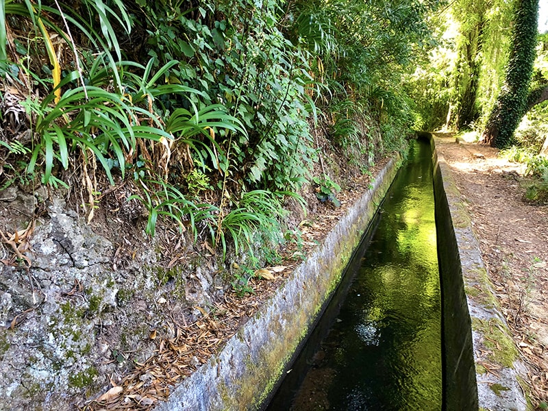
This route begins and ends in the charming village of Camacha (municipality of Santa Cruz) and follows part of the Levada do Caniço, which starts in the centre of Camacha and stretches up to the highest areas of Caniço. The levada is surrounded by a variety of stunning landscapes, with rich diversity of fauna and flora, and passes farmland with typical island plantations.

Community rating

3.7 / 5 from 36 hiker reviews on AllTrails

Getting to the trailhead

Directions to trailhead ↗


There's also a shorter Levada do Caniço route (8.7 km, moderate, ~3–3.5 hr) that covers a different section of the same levada — rated ⭐ 4.2 from 71 reviews on AllTrails — which may be a more accessible option if the full Camacha loop feels too long.

Want me to check the mountain weather forecast and IPMA warnings for the day you're planning to go, or show you the nearest official PR trails near Camacha?

OpenMadeira can make mistakes — check the sources.