Tell me about the Levada das 25 Fontes - Pico Fernandes - Pico da Urze levada walk in Madeira
💭 Thinking
The user is asking about a specific levada walk in Madeira - "Levada das 25 Fontes - Pico Fernandes - Pico da Urze". Let me search for this trail using the hikestool.The user asked about "Levada das 25 Fontes - Pico Fernandes - Pico da Urze levada walk." Let me analyze the results:
1. There is NO official IFCN PR trail with this exact name. The official trails in the Rabaçal area are:
- PR 6 – Levada das 25 Fontes
- PR 6.1 – Levada do Risco
- PR 6.2 – Levada do Alecrim
- PR 6.6 – Vereda do Túnel do Cavalo
- PR 6.8 – Levada do Paul II
2. In the community trails, I see one that matches partially: "Ovil - Levada do Alecrim - Levada do Pico da Urze" — this mentions Pico da Urze. Let me look at its description more carefully.
3. The user's query mentions "Pico Fernandes" — this isn't in any of the results directly. Let me search more specifically for this trail name.
Actually, looking more closely at the community trail "Ovil - Levada do Alecrim - Levada do Pico da Urze" — this is a community/unofficial trail that includes Pico da Urze. It's rated 4.4★ with 460 reviews, moderate difficulty, 4.2 km loop.
The user's specific trail name "Levada das 25 Fontes - Pico Fernandes - Pico da Urze" doesn't match any single trail in our results exactly. It seems to be a combined/extended route that hikers sometimes do, linking multiple levadas.
Let me search for this specifically to see if I can find more information about this particular combined route.
Actually, wait — there's also "Levada do Alecrim - Pico da Urze Dam" (community trail, 10.5 km, moderate, 4.5★, 175 reviews).
The name "Pico Fernandes" is a local landmark/peak in the Rabaçal/Paul da Serra area. The combined route "25 Fontes - Pico Fernandes - Pico da Urze" is a popular extended loop that many hikers do, but it's not an official PR trail — it's a combination of segments.
I should be transparent about this: there's no single official PR trail with this exact name. What the user is likely referring to is a popular combined route that links the Levada das 25 Fontes (PR 6) with paths to Pico Fernandes and Pico da Urze. Let me give them info about what I can confirm and explain this clearly.
Let me present the key information:
1. The official PR 6 – Levada das 25 Fontes (the core part of their route)
2. The community trail "Ovil - Levada do Alecrim - Levada do Pico da Urze" which includes Pico da Urze
3. Explain that the full route they're asking about is a combined/extended route, not a single official PR trail
I should also try a web_lookup to find more information about this specific combined route since it's not in our trail database as a single namedtrail.Now I have extensive information. Let me synthesize what I know about "Levada das 25 Fontes - Pico Fernandes - Pico da Urze" walk.
This is a combined route that isn't a single official PR trail — it's a popular longer circuit in the Rabaçal area that links multiple official trails together. The web search (from denivpositif.com) describes it very well as a full-day circuit combining:
1. **Levada do Alecrim** (parts of PR 6.2) heading up
2. A detour to **Pico Fernandes** (~1,403 m)
3. Continuing to **Lagoa do Vento** (Lagoa do Vento / Vereda da Lagoa do Vento)
4. Connecting down via **Levada do Risco** (PR 6.1)
5. Then **Levada das 25 Fontes** (PR 6)
6. Plus the **Levada do Pico da Urze** section
The key details from the web source (denivpositif.com):
- **Type:** Circuit
- **Duration:** 5–6 hours
- **Distance:** ~12.5 km
- **Elevation gain:** ~838 m
- **Altitude range:** 949 m – 1,315 m (or 1,403 m with Pico Fernandes detour)
- **Difficulty:** Intermediate
- **Highlights:** Levada do Alecrim, Lagoa do Lajeado, Pico Fernandes, Pico do Vento, Lagoa do Vento, Cascata do Risco, Cascata das 25 Fontes
From the first find_hikes call, I also got the community trail "Ovil - Levada do Alecrim - Levada do Pico da Urze" which is 4.2 km, loop, rated 4.4★ with 460 reviews on AllTrails, moderate difficulty.
And "Levada do Alecrim - Pico da Urze Dam" which is 10.5 km, out and back, rated 4.5★ with 175 reviews.
The "Viewpoints at Rabaçal and Pico do Vento" is 7.4 km, loop, rated 4.4★ with 120 reviews.
Also from hikingmadeira.com blog, PR 6.5 – Vereda do Pico Fernandes is described as:
- Distance: 3.8 km
- Starts from ER 209 on Paul da Serra plateau
- Follows an old path to PR 6 Levada das 25 Fontes
- Highlight: magnificent view from Pico Fernandes at ~1400 m altitude
- On clear days: 360° view of Paul da Serra, including Pico da Urze dam
Let me now compose a comprehensive answer about this combined walk. The user asked about "the Levada das 25 Fontes - Pico Fernandes - Pico da Urze levada walk" - this is a combined circuit route that connects multiple trails in the Rabaçal/Paul da Serra area.
The official PR trails in the area are:
- PR 6 – Levada das 25 Fontes (most popular, main trail)
- PR 6.1 – Levada do Risco
- PR 6.2 – Levada do Alecrim
- PR 6.6 – Vereda do Túnel do Cavalo
- PR 6.8 – Levada do Paul II
PR 6.5 – Vereda do Pico Fernandes is mentioned by the hikingmadeira.com blog as a NEW trail. It's not in our IFCN data from find_hikes, which suggests it may be very new or recently added.
The combined route "25 Fontes - Pico Fernandes - Pico da Urze" is a popular extended circuit that links these together. It's NOT a single official named PR trail — it's a combination route described on community sites like AllTrails (the "Levada do Risco - Cascata das 25 Fontes - Levada do Alecrim" loop at 12.7 km is the closest match).
Let me also mention the community trail matches:
- "Levada do Risco - Cascata das 25 Fontes - Levada do Alecrim" — 12.7 km loop, hard, 4.7★ (478 reviews)
- "Ovil - Levada do Alecrim - Levada do Pico da Urze" — 4.2 km loop, moderate, 4.4★ (460 reviews)
- "Levada do Alecrim - Pico da Urze Dam" — 10.5 km out and back, moderate, 4.5★ (175 reviews)
- "Viewpoints at Rabaçal and Pico do Vento" — 7.4 km loop, hard, 4.4★ (120 reviews)
Now let me write up the answer. The user asked in English, so I'll reply in English.
Key points to cover:
1. This is a combined circuit, not a single PR trail
2. The official PR trails it connects (PR 6, PR 6.1, PR 6.2)
3. The Pico Fernandes and Pico da Urze sections
4. Practical info: distance, duration, difficulty, altitude, access fees
5. Status (check current)
6. Community ratings fromAllTrailsThe user is asking about a specific combined route: "Levada das 25 Fontes - Pico Fernandes - Pico da Urze." This is not a single official PR trail but rather a combined route that hikers piece together from multiple trails in the Rabaçal area. Let me analyze what I've found:
1. **PR 6 - Levada das 25 Fontes** - Official PR trail, Moderate, 4.3 km (each way, 8.6 km round trip), starts at Rabaçal, ends at 25 Fontes waterfall. Open, €4.50 fee via SIMplifica.
2. **PR 6.2 - Levada do Alecrim** - Official PR trail, Easy, 3.5 km each way, starts at Rabaçal, ends at Lagoa Dona Beja. Open, €4.50 fee via SIMplifica.
3. **PR 6.5 - Vereda do Pico Fernandes** - This is a newer PR trail mentioned in the web results. From the hikingmadeira.com article: "PR 6.5 – Vereda do Pico Fernandes (Paul da Serra to 25 Fontes) - Distance: 3.8 km - Starting from the regional road (ER 209) on the Paul da Serra plateau, this trail follows an old path to PR 6 Levada das 25 Fontes, eventually leading to the lagoon of 25 Fontes. The highlight is the magnificent view from Pico Fernandes or Rabaçal at an altitude of 1400 meters. On clear days, enjoy a 360° view of Paul da Serra, including the impressive Pico da Urze dam."
4. **Pico da Urze** - The community trail "Ovil - Levada do Alecrim - Levada do Pico da Urze" and "Levada do Alecrim - Pico da Urze Dam" both reference the Pico da Urze area/dam.
The French hiking site (denivpositif.com) describes exactly this combined route: "From Vereda da Lagoa do Vento to Levada das 25 Fontes, this full-day itinerary follows the course of the Ribeira Grande and crosses no fewer than four hiking trails to reach hidden lagoons and waterfalls among dense vegetation. A varied and modular circuit that can also lead the more motivated to the summit of Pico Fernandes at 1403m altitude." It describes: Levada do Alecrim – Lagoa do Lajeado – Pico Fernandes – Pico do Vento – Lagoa do Vento – Cascata do Risco – Cascata das 25 Fontes.
And the "Viewpoints at Rabaçal and Pico do Vento" community trail (4.4★, 120 reviews, 7.4 km, hard, loop, 3.5-4hr) mentions: Pico da Urze viewpoint, Rabaçal viewpoint.
The combined route "Levada das 25 Fontes - Pico Fernandes - Pico da Urze" is a popular multi-segment day hike that links several trails in the Rabaçal/Paul da Serra area. It's not a single official PR trail, but rather a combination that hikers assemble from:
- PR 6 (Levada das 25 Fontes)
- PR 6.5 (Vereda do Pico Fernandes)
- Levada do Pico da Urze (community route)
- Possibly PR 6.2 (Levada do Alecrim) and connections
Let me now compose a comprehensive answer about this combined route, explaining what it is and the segments involved.
From the web search, I found important details about PR 6.5 Vereda do Pico Fernandes - it's 3.8 km, starts from ER 209 on Paul da Serra plateau, follows an old path to PR 6, with the highlight being the view from Pico Fernandes at ~1400m altitude with 360° views including the Pico da Urze dam.
The Pico da Urze dam/levada area is referenced in the community trails (Ovil - Levada do Alecrim - Levada do Pico da Urze, and Levada do Alecrim - Pico da Urze Dam).
The full combined circuit described on denivpositif.com is:
- Type: Circuit
- Duration: 5-6h
- Distance: 12.5 km
- Elevation gain: 838m
- Altitude min: 949m, max: 1315m
- Difficulty: Intermediate
Key waypoints: Levada do Alecrim – Lagoa do Lajeado – Pico Fernandes – Pico do Vento – Lagoa do Vento – Cascata do Risco – Cascata das 25 Fontes
Adding Pico Fernandes summit adds about 1 extra hour.
Now let me write a thorough answer about this combined walk.
Viewpoints at Rabaçal and Pico do Vento 4.4 Directions
Photos: walkmeguide.com · green = official IFCN PR trail · amber = community route (AllTrails)
Levada das 25 Fontes – Pico Fernandes – Pico da Urze
This is a combined, multi-segment day hike in the Rabaçal/Paul da Serra area — not a single official PR trail, but a popular circuit that links several trails together through one of Madeira's most spectacular valley systems. It takes you from lush levada paths to mountain summits, passing waterfalls, lagoons, and panoramic viewpoints along the way.
The segments
The full loop connects these waypoints:
Levada do Alecrim → Lagoa do Lajeado → Pico Fernandes (~1,400 m) → Pico do Vento → Lagoa do Vento → Cascata do Risco → Cascata das 25 Fontes
Total distance
~12.5 km (loop)
Duration
5–6 h
Elevation gain
~838 m
Altitude range
949 m – 1,315 m (or ~1,400 m with Pico Fernandes detour)
Difficulty
Intermediate to hard
Key highlights along the route
Pico Fernandes (~1,400 m) — A summit detour (~1 h extra) with a 360° panorama over Paul da Serra, the Rabaçal valley, and the Pico da Urze dam. On clear days the views are outstanding.
Lagoa do Vento (Lagoa da Dona Beja) — A serene lagoon and small waterfalls where you can swim on warm days, reached via PR 6.2 Levada do Alecrim.
Pico do Vento — A secondary viewpoint along the ridge before descending into the Rabaçal valley.
Cascata do Risco (PR 6.1) — A dramatic ~100 m two-tier waterfall.
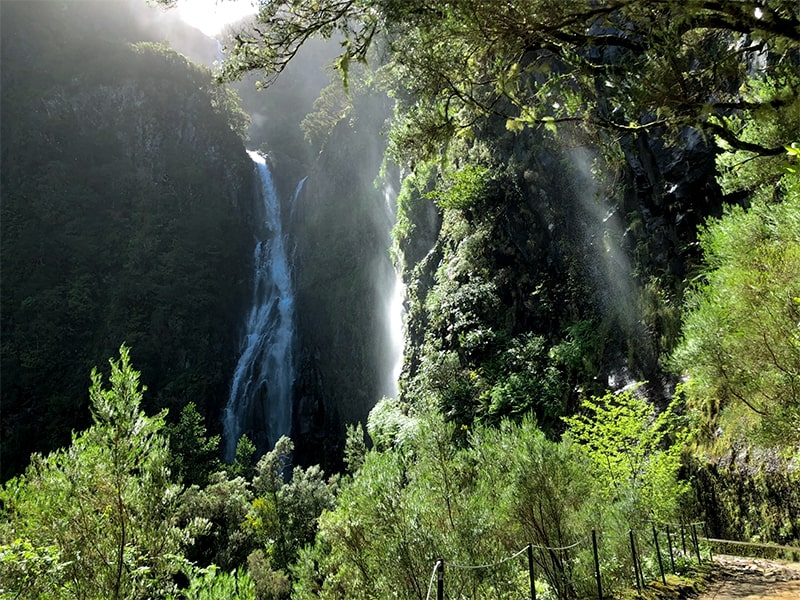
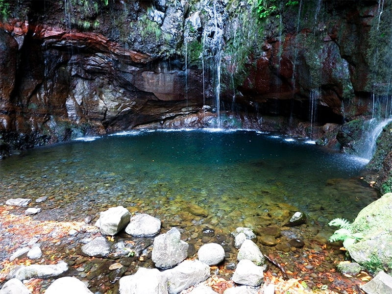
Cascata das 25 Fontes (PR 6) — The famous "weeping wall" — 25+ springlets cascading down a mossy amphitheatre into a natural pool. Madeira's most iconic levada destination.
The official trails you'll use
Trail
PR Code
Difficulty
Distance
Key feature
Levada das 25 Fontes
PR 6
Moderate
4.3 km each way
The 25-spring waterfall
Levada do Risco
PR 6.1
Easy
3 km each way
Risco waterfall
Levada do Alecrim
PR 6.2
Easy
3.5 km each way
Lagoa Dona Beja & waterfalls
Vereda do Pico Fernandes
PR 6.5
—
~3.8 km
Summit detour with 360° views
The PR 6.5 (Vereda do Pico Fernandes) is the newest addition to this area's network. It starts from the ER 209 on the Paul da Serra plateau and follows an old path down toward PR 6, with the highlight being the panoramic viewpoint at Pico Fernandes (~1,400 m), offering views across Rabaçal valley and the Pico da Urze dam.
Access & fees
There is an access fee for the Rabaçal area (covering the PR trails):
€4.50 per visitor (> 12 years), bookable via the SIMplifica portal
Children ≤ 12 years: free
Protocol/tour operators can include the discounted €3 rate in their guided tour price
Starting point & logistics
All trails converge on Rabaçal, on the ER 105 across the Paul da Serra plateau:
By car: ~50 min from Funchal, ~20 min from Calheta. Free parking at the Rabaçal car park, but it fills early — arrive before 9:00 in summer.
Shuttle: A small bus runs from the car park down to the Casa do Rabaçal (trailhead) roughly every 10 minutes between 10:00–18:00 (€3 one way / €5 return, cash only). If you start early or after hours, it's a 2 km walk down.
No public transport reaches Rabaçal directly.
Community routes in the area
Beyond the official PR trails, AllTrails maps several combined routes that overlap with this circuit — these are community routes, not part of Madeira's official IFCN-managed PR trail network, so they have no official open/closed status and no maintenance guarantee:
Check the current open/closed/restricted status before setting out — conditions can change due to weather or maintenance. As of now the key PR trails in this area (PR 6, 6.1, 6.2) are open.
Tips for this route
Start early (before 9:00) — this is Madeira's busiest trail area and the 25 Fontes in particular gets very crowded by midday.
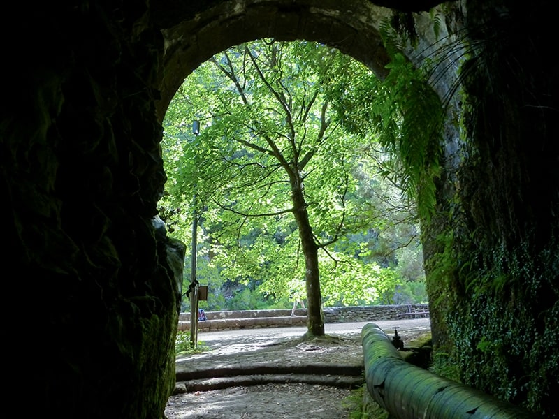
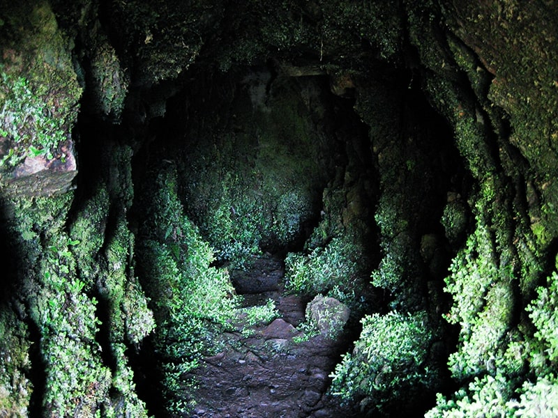
Bring a headlamp — if you do the variant via the Rabaçal Tunnel (PR 6.6), the 800 m tunnel is completely dark.
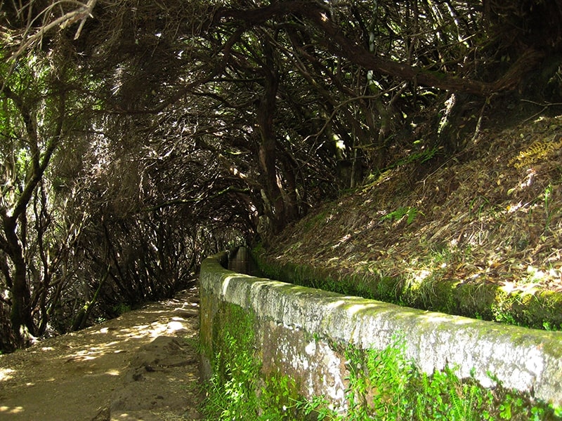
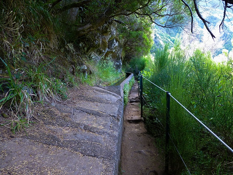
Wear hiking boots with good grip — levada paths can be slippery, especially after rain, and some sections are narrow with drops.
Pack layers and rain gear — Paul da Serra sits at ~1,300 m and can be foggy, wet, and 10 °C cooler than Funchal.
Allow extra time for the Pico Fernandes summit — it adds ~1 h but the panoramic views are worth it on a clear day.
The 25 Fontes lagoon is a popular spot for a quick dip — bring a swimsuit if it's warm.