OpenMadeira
Tell me about the Levada do Alecrim - Levada do Pico da Urze levada walk in Madeira
💭 Thinking
The user is asking about the "Levada do Alecrim - Levada do Pico da Urze" levada walk in Madeira. I should look this up using the hikes tool to get the official trail information, and also find curated videos if available. Let me search for this trail using find_hikes.The find_hikes query returned no results. Let me try a different search approach - maybe searching for just "Alecrim" or the PR code.The user asked about "Levada do Alecrim - Levada do Pico da Urze" levada walk. Let me look at the results carefully. In the community trails, I found the exact match: "Ovil - Levada do Alecrim - Levada do Pico da Urze" — this is a community/unofficial trail on AllTrails, NOT an official IFCN PR trail. It has a 4.4★ rating from 467 reviews, is 4.2 km, moderate difficulty, loop route, in the Madeira Natural Park area. There's also a closely related community trail: "Levada do Alecrim - Pico da Urze Dam" — 10.5 km, moderate, out and back, 4.6★ from 149 reviews. And there's the official PR 6.2 — Levada do Alecrim, which is an official IFCN trail: Easy, 3.5 km (+3.5 km return), 2:30 hours, from Rabaçal to the water spring of Levada do Alecrim (Lagoa 'Dona Beja'), max altitude 1339m, min 1256m, requires SIMplifica payment (€4.50 for visitors >12 years). The user specifically asked about "Levada do Alecrim - Levada do Pico da Urze" — this matches the community trail "Ovil - Levada do Alecrim - Levada do Pico da Urze" most directly. Let me present this information. I should note this is NOT an official IFCN PR trail but rather a community route mapped on AllTrails. I need to give the full caveat. Description: "This trail runs along the Levada do Pico da Urze, an ancient levada, which is still naturally excavated in the ground and without artificial coating for most of the route. It belongs to the first generation of levadas that irrigated the southern lands, with springs from the north of the island. Levada do Pico da Urze was remodeled, included in the works of Expansion of the Electrical Use of Calheta to be carried out by EEM. It was rebuilt in concrete to increase the flow and reduce losses..." Let me also mention the official PR 6.2 Levada do Alecrim trail since it's closely related and nearby. Now let me also get a video of this trail.Let me analyze what I found. The user asked about "Levada do Alecrim - Levada do Pico da Urze" levada walk. From the hike results, this specific trail appears as a community trail (not an official IFCN PR trail): **"Ovil - Levada do Alecrim - Levada do Pico da Urze"** - Community route mapped on AllTrails — not part of Madeira's official PR trail network managed by IFCN - Rating: 4.4★ / 467 reviews - Difficulty: moderate - Length: 4.2 km - Route type: loop - Lat/Lng: 32.75739, -17.10542 - Description: This trail runs along the Levada do Pico da Urze, an ancient levada, which is still naturally excavated in the ground and without artificial coating for most of the route. It belongs to the first generation of levadas that irrigated the southern lands, with springs from the north of the island. Levada do Pico da Urze was remodeled, included in the works of Expansion of the Electrical Use of Calheta to be carried out by EEM. It was rebuilt in concrete to increase the flow and reduce losses. There's also a related community trail: **"Levada do Alecrim - Pico da Urze Dam"** - 4.6★ / 149 reviews - Difficulty: moderate - Length: 10.5 km - Route type: out and back - 3-3.5 hr And the official PR trail: **PR 6.2 - Levada do Alecrim** - Official IFCN trail - Distance: 3.5 km (+ 3.5 km return) - Difficulty: Easy - Duration: 2:30 hours - Start: Rabaçal (E.R. 105) - End: Water spring of Levada do Alecrim (Lagoa 'Dona Beja') - Max altitude: 1339m, Min altitude: 1256m - Access fee: €4.50 (visitor >12 years), exempt ≤12 years - 4.6★ from 1798 AllTrails reviews The user specifically asked about "Levada do Alecrim - Levada do Pico da Urze" which is the combined route. The closest match in our data is the community trail "Ovil - Levada do Alecrim - Levada do Pico da Urze" — a 4.2 km loop, moderate difficulty, 4.4★ from 467 reviews. I should present this community trail clearly with the unofficial-trail caveat, and also mention the official PR 6.2 Levada do Alecrim as context since part of the route overlaps. Let me also get a video to show.
How this was derived · 3 steps
Trails near RabaçalMap & photos
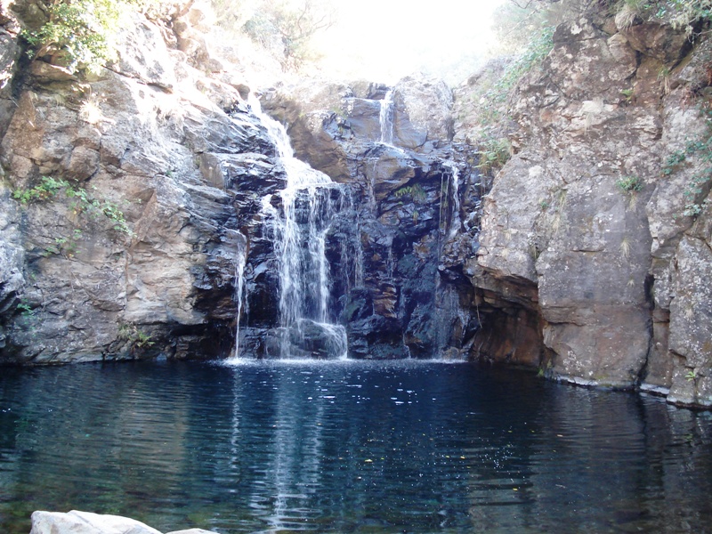
Levada do Alecrim6 photos
Levada do AlecrimLevada do AlecrimLevada do AlecrimLevada do AlecrimLevada do AlecrimLevada do Alecrim
Official PR trail (IFCN) Community route (AllTrails — not official)
Photos: walkmeguide.com · green = official IFCN PR trail · amber = community route (AllTrails)

The Levada do Alecrim – Levada do Pico da Urze walk is a community route on the Paul da Serra plateau, in the Rabaçal area of Madeira's Natural Park. Here's what you need to know:


⚠️ Important: This is NOT an official IFCN PR trail

This route is a community trail mapped on AllTrails — it is not part of Madeira's official PR (Percurso Recomendado) trail network managed by IFCN (the regional government's forests & nature-conservation authority). It therefore has no official open/closed status and no maintenance or signage guarantee. Check access and conditions locally before going.


The Trail at a Glance
NameOvil – Levada do Alecrim – Levada do Pico da Urze
Distance4.2 km (loop)
DifficultyModerate
Community rating4.4★ from 467 reviews on AllTrails ↗
LocationMadeira Natural Park, Paul da Serra plateau
What It's Like

The trail follows the Levada do Pico da Urze, an ancient levada that is still naturally excavated in the ground for most of its length, without artificial coating. It belongs to the first generation of levadas that once irrigated the southern lands, with springs fed from the north of the island. The Levada do Pico da Urze was later remodelled as part of the Expansion of the Electrical Use of Calheta (EEM) — rebuilt in concrete to increase flow and reduce losses.

You'll also walk along a section of the Levada do Alecrim, which connects the route. The landscape is moorland plateau terrain with sweeping views across the Paul da Serra and down into the Rabaçal valley.

Getting to the Trailhead

The trailhead is near Rabaçal on the ER105 road at roughly 1,274 m elevation. Directions ↗


Nearby Official PR Trail (for comparison)

The official PR 6.2 – Levada do Alecrim starts from the same Rabaçal area and is the IFCN-managed counterpart for part of this route:

CodePR 6.2
Distance3.5 km + 3.5 km return (7 km total)
DifficultyEasy
Duration~2 h 30 min
Start / EndRabaçal (ER 105) → Lagoa Dona Beja (water spring)
Altitude1,256 m – 1,339 m
Access fee€4.50 (visitors >12 years), free ≤12 years (via SIMplifica portal)
Community rating4.6★ from 1,798 reviews on AllTrails ↗

Details on VisitMadeira ↗


Before You Go
  • Check the current trail status on openmadeira.org before setting out — the community route has no official status, and conditions can change.
  • Weather on the Paul da Serra plateau changes fast and fog is common; dress in layers and take waterproofs.

Want me to check the mountain weather forecast and any IPMA warnings for the day you're planning to go?

OpenMadeira can make mistakes — check the sources.