💭 Thinking
How this was derived · 5 steps
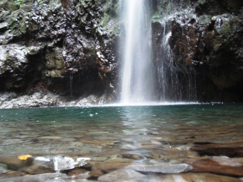


- Levada do Caldeirão Verde 4.6 Directions
The Levada do Caldeirão Verde – Vereda do Pico Ruivo is a popular but unofficial combined route — it stitches together sections of two of Madeira's most iconic official trails into one epic day hike. Here's everything you need to know.
This combined walk is not part of Madeira's official PR (Percurso Recomendado) trail network managed by IFCN (the regional government's forests & nature-conservation authority). That means it has no official open/closed status and no guaranteed maintenance or signage for the full combined route. It's a community-mapped route on AllTrails that joins portions of PR 9 and PR 1.2 — both of which are official. Always check the current trail status on OpenMadeira before setting out.
| Levada do Caldeirão Verde – Vereda do Pico Ruivo | |
|---|---|
| Type | Out and back |
| Distance | 18.2 km |
| Estimated time | 9–10 hours |
| Difficulty | Hard |
| Start point | Queimadas Forest Park (Santana) |
| AllTrails rating | 4.6★ from 87 reviews |
It begins at Queimadas and follows the Levada do Caldeirão Verde deep into the lush laurel forest before climbing steeply up to Pico Ruivo (1,862 m) — Madeira's highest peak — via the Vereda do Pico Ruivo. The large elevation gain and long distance make this one of the island's most demanding day hikes, requiring excellent physical fitness. Madeira's mountain weather is notoriously volatile, so plan accordingly and start early.
Directions to trailhead ↗ · AllTrails page ↗
| Route | Queimadas → Caldeirão Verde → Caldeirão do Inferno |
| Distance | 8.7 km (+ 8.7 km return) |
| Duration | ~6 h 30 min |
| Difficulty | Moderate |
| Start | Queimadas Forest Park |
| End | Caldeirão do Inferno |
| Altitude | 872 m – 1,020 m |
| Access fee | €4.50 (visitors > 12 years); free ≤ 12 years · Parking €2.00/hr |
| AllTrails | 4.6★ from 4,562 reviews |
One of Madeira's most celebrated levada walks — you follow the 18th-century water channel through the Laurissilva forest, pass through hand-carved tunnels, and arrive at the spectacular Caldeirão Verde (Green Cauldron) waterfall. Beyond it, the trail continues to Caldeirão do Inferno. The Queimadas Shelter House at the start is a charming thatched-roof building typical of Santana's traditional architecture.
Visit Madeira ↗ · Directions ↗ · Photos: walkmeguide.com
| Route | Achada do Teixeira → Pico Ruivo |
| Distance | 2.8 km (+ 2.8 km return) |
| Duration | ~1 h 30 min |
| Difficulty | Moderate |
| Start | Achada do Teixeira |
| End | Pico Ruivo (1,862 m — Madeira's highest point) |
| Altitude | 1,852 m – 1,857 m |
| Access fee | €4.50 (visitors > 12 years); free ≤ 12 years |
The shortest and most popular way to reach Madeira's summit. From the Achada do Teixeira trailhead, it's a steep but well-constructed path through rugged, high-altitude terrain — often above the clouds. The panoramic 360° views from the summit are among the best on the island.
Visit Madeira ↗ · Directions ↗ · Photos: walkmeguide.com
- Start very early (before 8:00) — 18 km with serious elevation gain is a long day, and mountain weather can turn in the afternoon.
- Both trails require a fee (€4.50 each via the SIMplifica portal) — if you combine them, you'll pass through two fee areas.
- Bring a headtorch — the Caldeirão Verde section includes several unlit tunnels.
- Check the current trail status on OpenMadeira before you go, as conditions can change (rockfalls, landslides, storm damage).
- Mountain weather matters — at ~1,800 m, Pico Ruivo can be in thick fog, high winds, or even ice; check the IPMA forecast and warnings for the mountain regions before committing.
Would you like me to check the mountain forecast and IPMA weather warnings for the day you're planning to go, or help you find how to get to Queimadas by bus?