💭 Thinking
How this was derived · 2 steps


- Levada dos Cedros 4.5 Directions
- Vereda do Fanal 4.4 Directions
- Rota dos Fios 4.5 Directions
- Fanal Short Loop 4.6 Directions
- Green Trail: Lagoa Trail 4.5 Directions
- Fanal Forest Path 4.5 Directions
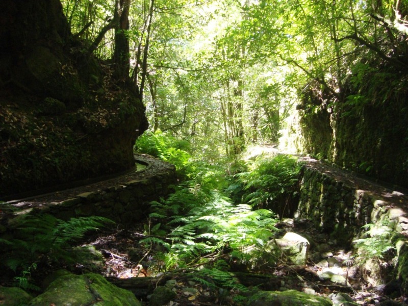
Fanal is one of Madeira's most magical spots — a plateau of centuries-old Laurissilva forest (UNESCO World Heritage) at roughly 1,100–1,130 m altitude, frequently cloaked in mist, with twisted, moss-draped laurel trees and sweeping views over the north coast valleys. There are two official PR trails that pass through/start from Fanal, plus several popular community routes around the immediate viewpoint area.
| Route | Paul da Serra (Assobiadores) → Fanal |
| Distance | 10.8 km |
| Difficulty | Moderate |
| Duration | ~4 h (official) / 8–9 h round-trip (AllTrails) |
| Altitude | 1,130 m → 1,420 m |
| Access fee | €4.50 via SIMplifica (free ≤ 12 years) |
| Community rating | 4.4★ from 556 reviews on AllTrails |
This is the classic Fanal levada walk — a long traverse along the levada from the Paul da Serra plateau down to the Fanal forestry post. It winds through dense laurel forest and open ridge-top sections with dramatic views, ending at the iconic Fanal house and ancient Tis trees. The going is moderately graded thanks to the levada, but the length and altitude make it a solid half-day hike.
Full trail info ↗ · Directions to trailhead ↗
| Route | Fanal → Curral Falso |
| Distance | 7.2 km |
| Difficulty | Moderate |
| Duration | ~3 h |
| Altitude | 840 m → 1,090 m |
| Access fee | €4.50 via SIMplifica (free ≤ 12 years) |
| Community rating | 4.5★ from 1,144 reviews on AllTrails |
This is the closest official trail to the Fanal viewpoint (just a 2-minute drive / 400 m from the area). It follows the Levada dos Cedros westward from Fanal through the laurel forest towards Curral Falso, descending gradually. Beautiful, well-shaded, and one of the island's most popular levada walks.
Full trail info ↗ · Directions to trailhead ↗
Around the Miradouro do Fanal viewpoint itself there are several shorter, well-rated community routes (mapped on AllTrails — not part of Madeira's official PR trail network managed by IFCN, so they have no official open/closed status):
| Trail | Length | Difficulty | Rating | Highlights |
|---|---|---|---|---|
| Fanal Short Loop | 1.9 km | Moderate | 4.6★ (385) | Circle through the mossy laurel forest & viewpoints |
| Ribeira Funda Viewpoint – Lagoa do Fanal | 3.4 km | Easy | 4.5★ (346) | Viewpoint over Ribeira Funda + Lagoa do Fanal lagoon |
| Green Trail: Lagoa Trail | 2.1 km | Easy | 4.5★ (256) | Family walk to the Fanal winter lagoon, past grand Tis trees |
| Rota dos Fios | 4.2 km | Easy | 4.5★ (631) | Laurel forest loop past the historic "Fios" cable system |
| Fanal Forest Path | 0.6 km | Easy | 4.5★ (227) | Tiny loop through the enchanted misty forest |
These are ideal if you want a shorter stroll right from the Fanal viewpoint car park — especially the Fanal Short Loop (4.6★) and the Lagoa do Fanal viewpoint route.
- Access fee: The official PR trails in this area (PR 13 & PR 14) require a €4.50 payment via the SIMplifica portal (free for children ≤ 12).
- Weather: Fanal sits above 1,100 m and is famously misty/foggy — check the mountain forecast and IPMA weather warnings before setting out. Fog can reduce visibility to near zero; conversely, clear days give stunning views.
- Current trail status: Always check the latest open/closed status on openmadeira.org before you go, as conditions can change.
Would you like me to check the mountain weather forecast and IPMA warnings for Fanal tomorrow, or find out how to get there by bus?