💭 Thinking
How this was derived · 1 step
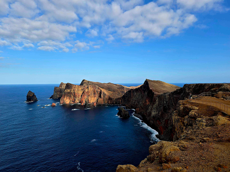


- Vereda da Ponta de S. Lourenço 4.7 Directions
- Pico das Roçadas Trail 4.4 Directions
The walk you're asking about — Pico Castanho – Pico das Roçadas – Túnel do Caniçal — isn't one of Madeira's official PR (Percurso Recomendado) trails managed by IFCN. It's a community route mapped on AllTrails, which means it has no official open/closed status, no maintained signage, and no guaranteed maintenance — check local conditions before setting out.
The closest match in our database is the Vereda Boca do Risco/Caniçal – Pico das Roçadas – Levada do Caniçal, which covers the key features you mentioned:
| Type | Loop |
| Distance | 6.9 km |
| Difficulty | Moderate |
| Community rating | 4.4★ from 581 reviews on AllTrails |
| Area | Madeira Natural Park, near Caniçal |
Starting at Vereda da Boca do Risco (Caniçal), this circular trail winds through the region's agricultural landscape and exotic flora along Madeira's coastline. It climbs through rocky mountainsides with breathtaking views over the coastline up to Pico das Roçadas, then joins the Levada do Caniçal — the old irrigation channel that passes through the famous Túnel do Caniçal — with sweeping vistas over the city of Machico and the vast Atlantic Ocean.
Pico Castanho is one of the peaks you'll pass along this route on the ridge between Boca do Risco and Pico das Roçadas.
- Boca do Risco — one of the most dramatic clifftop viewpoints on Madeira's east coast
- Pico das Roçadas — a rocky summit with panoramic ocean and coastal views
- Túnel do Caniçal — the hand-carved water tunnel along the Levada do Caniçal (bring a torch/flashlight)
- Levada do Caniçal — the historic irrigation channel contouring back towards the village
If you want shorter or longer alternatives covering the same terrain:
| Route | Distance | Difficulty | Rating | Notes |
|---|---|---|---|---|
| Pico das Roçadas Trail | 3.9 km loop | Moderate | 4.4★ (119 reviews) | Just the Pico das Roçadas circuit — shorter version |
| Vereda Boca do Risco Caniçal – Levada do Caniçal | 14.6 km loop | Hard | 4.7★ (168 reviews) | Full Boca do Risco + Levada do Caniçal loop |
| Rota da Boca do Risco – Levada do Caniçal | 13.5 km loop | Hard | 4.5★ (106 reviews) | Machico to north coast via Boca do Risco |
All of these are community routes — not official IFCN-recommended PR trails — so there's no official open/closed status to check. Assess conditions locally before heading out, especially for the tunnel section and cliff-edge paths.
The nearest official PR trail is PR 8 – Vereda da Ponta de S. Lourenço (4 km one-way, moderate, 4.7★ from 7,989 reviews), just ~5 km east — a spectacular coastal walk on the easternmost peninsula.
Want me to check the mountain forecast and IPMA weather warnings for the Caniçal area, or show you a video of this trail?