💭 Thinking
How this was derived · 3 steps
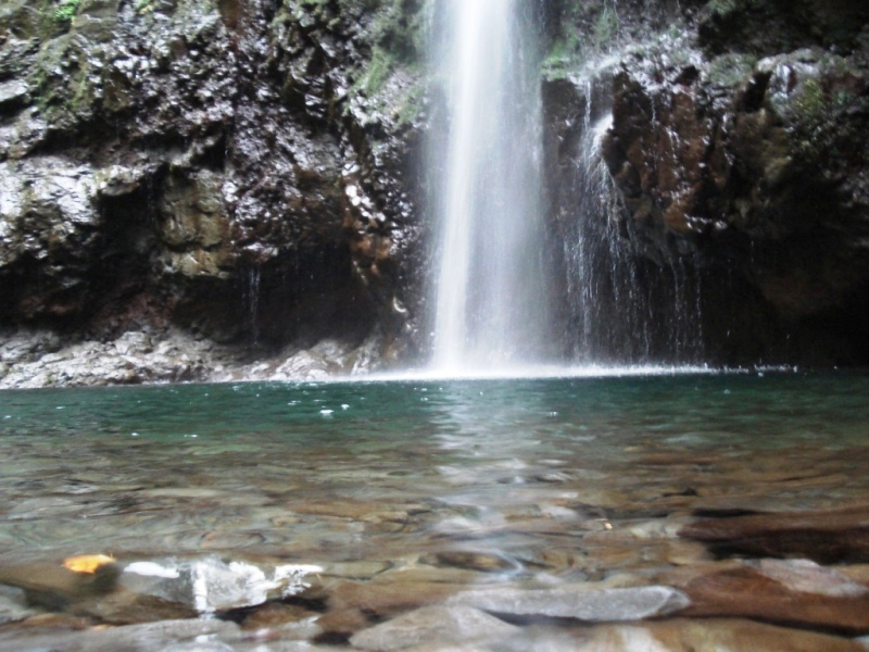


- Levada do Caldeirão Verde 4.6 Directions
This is a combined route that links two of Madeira's official PR trails into one longer hike — the Levada do Caldeirão Verde (PR 9) and the Vereda da Ilha (PR 1.1). It's mapped on AllTrails as a community route — not part of Madeira's official PR trail network managed by IFCN (the regional government's forests & nature-conservation authority), so it has no official open/closed status and no maintenance or signage guarantee beyond the individual PR sections.
| Detail | |
|---|---|
| Difficulty | Hard |
| Distance | 14.8 km |
| Estimated time | 7.5–8.5 hr |
| Route type | Point to point |
| Area | Parque Florestal das Queimadas |
| Community rating | 4.2★ from 44 reviews on AllTrails |
The route starts on the accessible Caminho para Todos path (PR 9.1) until it reaches the Parque das Queimadas. From there, you follow the Levada do Caldeirão Verde to the spectacular waterfall of Caldeirão Verde. You then return to the junction with PR 1.1 (Vereda da Ilha) and continue to the endpoint at Ilha.
⚠️ Important: Since this is an unofficial combination, check current trail status and access conditions locally before setting out. The individual PR trails may have restrictions or closures that affect parts of this route.
▶ Directions to the trailhead ↗ · AllTrails page ↗
| Detail | |
|---|---|
| Distance | 8.7 km one way (17.4 km return) |
| Difficulty | Moderate |
| Duration | ~6 h 30 min |
| Route | Queimadas → Caldeirão Verde → Caldeirão do Inferno |
| Max altitude | 1,020 m |
| Access fee | €4.50 (visitors > 12 years; free for ≤ 12 years) via SIMplifica portal |
| Parking | €2.00/hour |
| AllTrails | 4.6★ from 4,562 reviews |
One of Madeira's most famous levada walks, passing through lush Laurissilva forest with tunnels carved into rock and ending at the magnificent Caldeirão Verde waterfall (and onward to Caldeirão do Inferno). Starts at Queimadas Forest Park, where you'll also find a thatched-roof shelter house in the traditional Santana style.
▶ Visit Madeira page ↗ · Directions ↗
| Detail | |
|---|---|
| Distance | 8.2 km |
| Difficulty | Moderate |
| Duration | ~3 hours |
| Route | Pico Ruivo → Ilha |
| Max altitude | 1,764 m · Min 490 m |
| Access fee | €4.50 (visitors > 12 years; free for ≤ 12 years) via SIMplifica portal |
| AllTrails | 4.6★ from 161 reviews |
Descends from Madeira's highest peak area through dramatic mountain terrain to Ilha, with spectacular views along the way.
▶ Visit Madeira page ↗ · Directions ↗
- Check current trail status — the IFCN-managed sections can be closed or restricted (tunnels, rockfall, maintenance). Always verify before setting out.
- Bring a torch/headlamp — the Caldeirão Verde levada passes through several unlit tunnels.
- Access fees apply to both PR 9 and PR 1.1 sections (€4.50 each via the SIMplifica portal).
- Point-to-point logistics — this combined route doesn't start and end at the same point, so arrange transport accordingly.
Would you like me to check the current trail status or the mountain weather forecast for the day you're planning to go?