OpenMadeira
Tell me about the PR 1 Vereda do Areeiro hike in Madeira
💭 Thinking
The user wants to know about the PR 1 Vereda do Areeiro hike in Madeira. Let me look this up using the find_hikes tool.The result came back with count:0 and no hikes data, but there's a note about an evergreen trail guide. Let me try the search again with a slightly different approach - maybe searching by name alone without the PR code, or using "near" parameter. Let me try again with just the name.I found the PR 1 Vereda do Areeiro trail. Let me extract the key details: - **PR Code:** PR 1 - **Name:** Vereda do Areeiro - **Route:** Pico do Areeiro – Pico Ruivo * Vereda oeste (pelos túneis) * Vereda este (pelo Pico das Torres) - Encerrado - **Distance:** 6.1 km - **Difficulty:** Moderate (IFCN), but AllTrails rates it as hard - **Duration:** 3:30 hours - **Start point:** Pico do Areeiro Viewpoint - **End point:** Pico Ruivo - **Max altitude:** 1857 m - **Min altitude:** 1491 m - **Managing entity:** IFCN - **Access:** Payment via SIMplifica portal - €4.50 for visitors > 12 years, free for ≤ 12 years. Parking €4.00/hour - **Status:** The status field is empty in the data... The note says "This is an EVERGREEN trail guide for a static page. Do NOT state any open/closed/restricted status — it is DELIBERATELY omitted here because it changes over time and this page is cached." Wait, actually looking more carefully, the route field says: "Pico do Areeiro – Pico Ruivo * Vereda oeste (pelos túneis) * Vereda este (pelo Pico das Torres) - Encerrado" — the "Encerrado" part seems to indicate that the eastern route via Pico das Torres is closed. But the main trail status is empty. Also, the AllTrails rating: 4.6★ from 4,384 reviews. The AllTrails page is at: https://www.alltrails.com/trail/portugal/madeira--2/pr1-pico-do-arieiro-pico-ruivo There's a live webcam at Pico do Areeiro: https://www.netmadeira.com/webcams/show/netmadeira/pico-do-areeiro Let me also find a video to show. I should note that this is one of Madeira's most iconic hikes, connecting two of the island's highest peaks. The route goes through tunnels, with stunning mountain scenery. The status field is empty, which per the note means I should NOT state an open/closed status and instead tell the reader to check current status. But wait - per my instructions, I should ALWAYS state the trail's status. Since the tool returned empty status, I should tell the user to check the current status before setting out. Actually, let me re-read: "This is an EVERGREEN trail guide for a static page. Do NOT state any open/closed/restricted status — it is DELIBERATELY omitted here because it changes over time and this page is cached." So the status was deliberately omitted. In my hiking domain instructions, it says: "ALWAYS state the trail's STATUS (open / closed / restricted) — lead with it." But if the tool didn't return a status, I should note that. Actually, looking at this more carefully - this note is part of the evergreen/cached page context, not a live result. The status field is literally empty (""). I should note this to the user and advise checking current status. Let me also get a YouTube video of this trail and maybe thewebcam.
How this was derived · 2 steps
Trails near Pico do AreeiroMap & photos
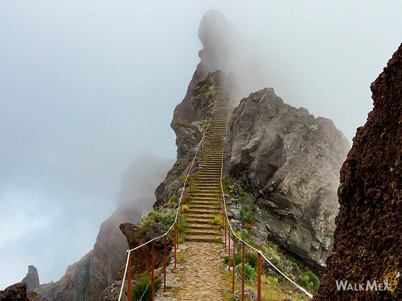
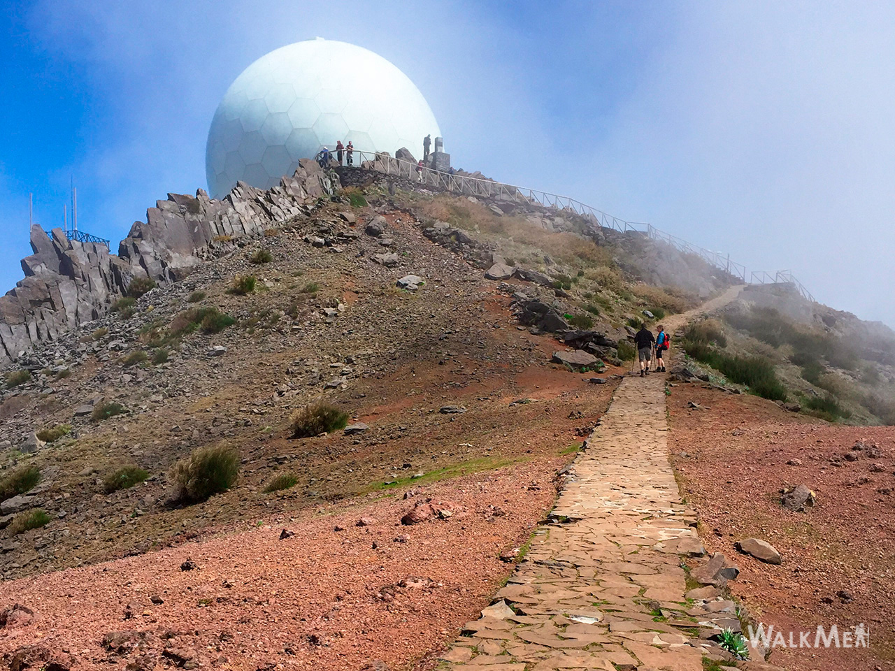
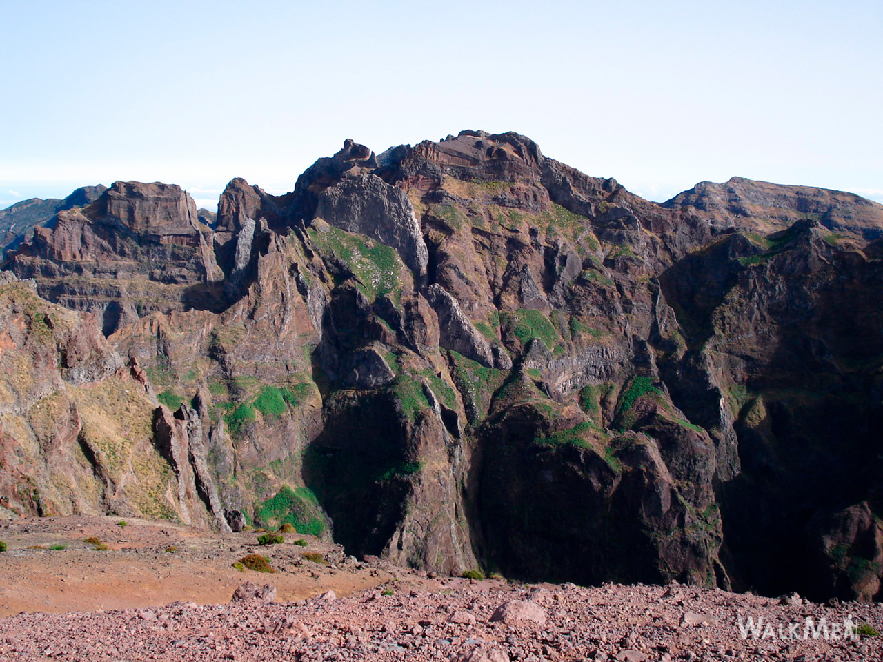
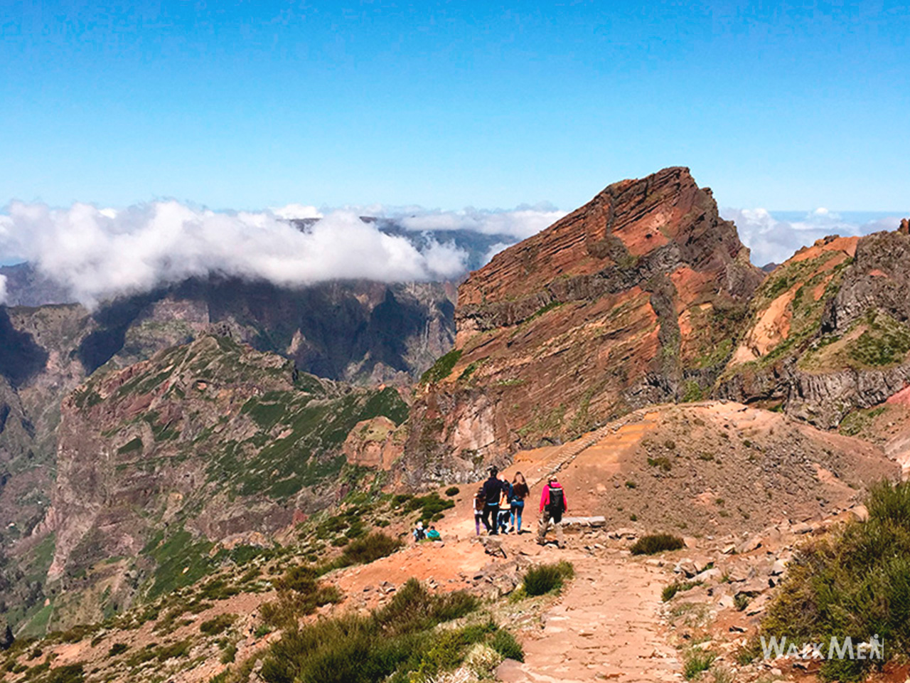
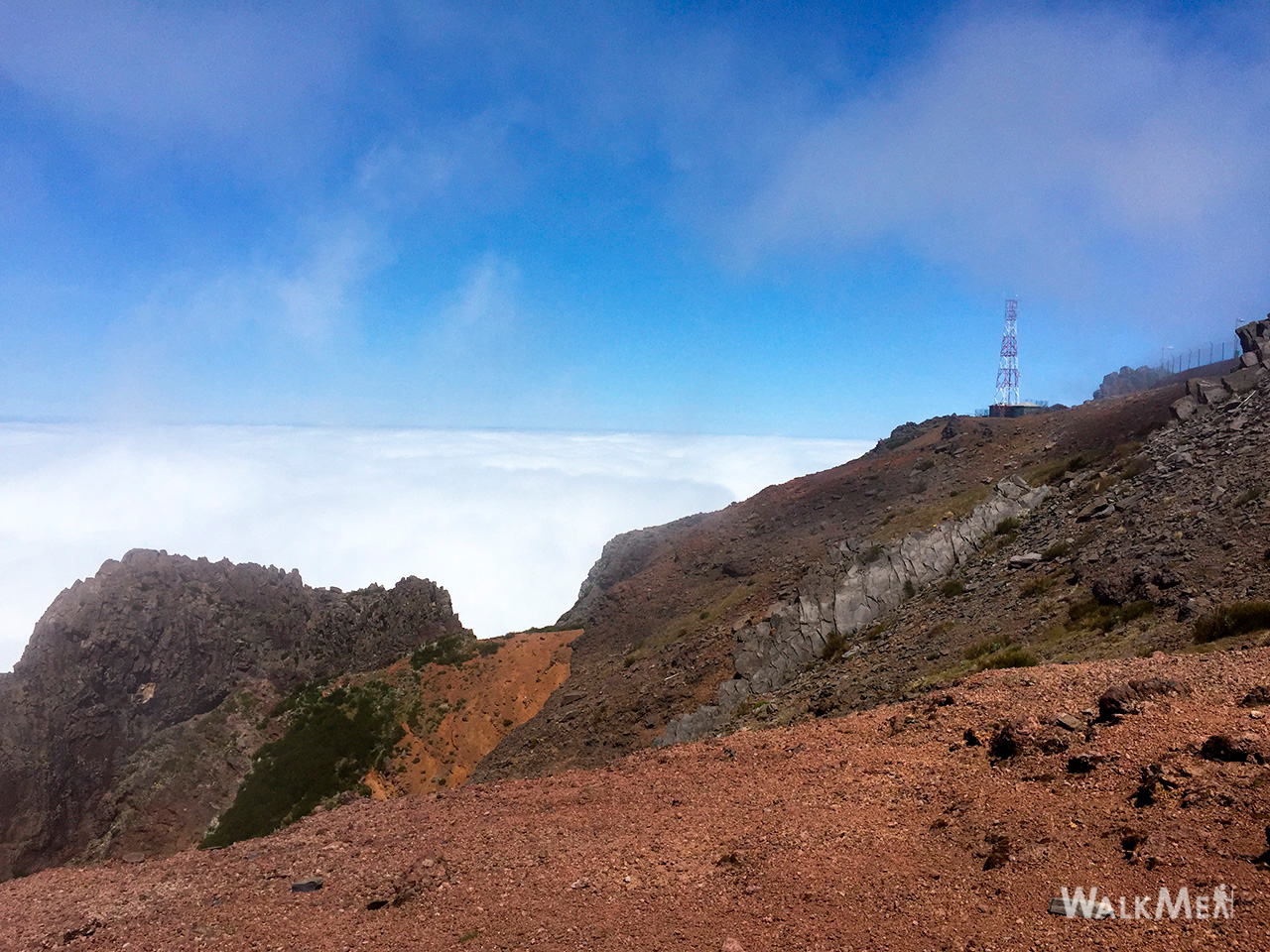
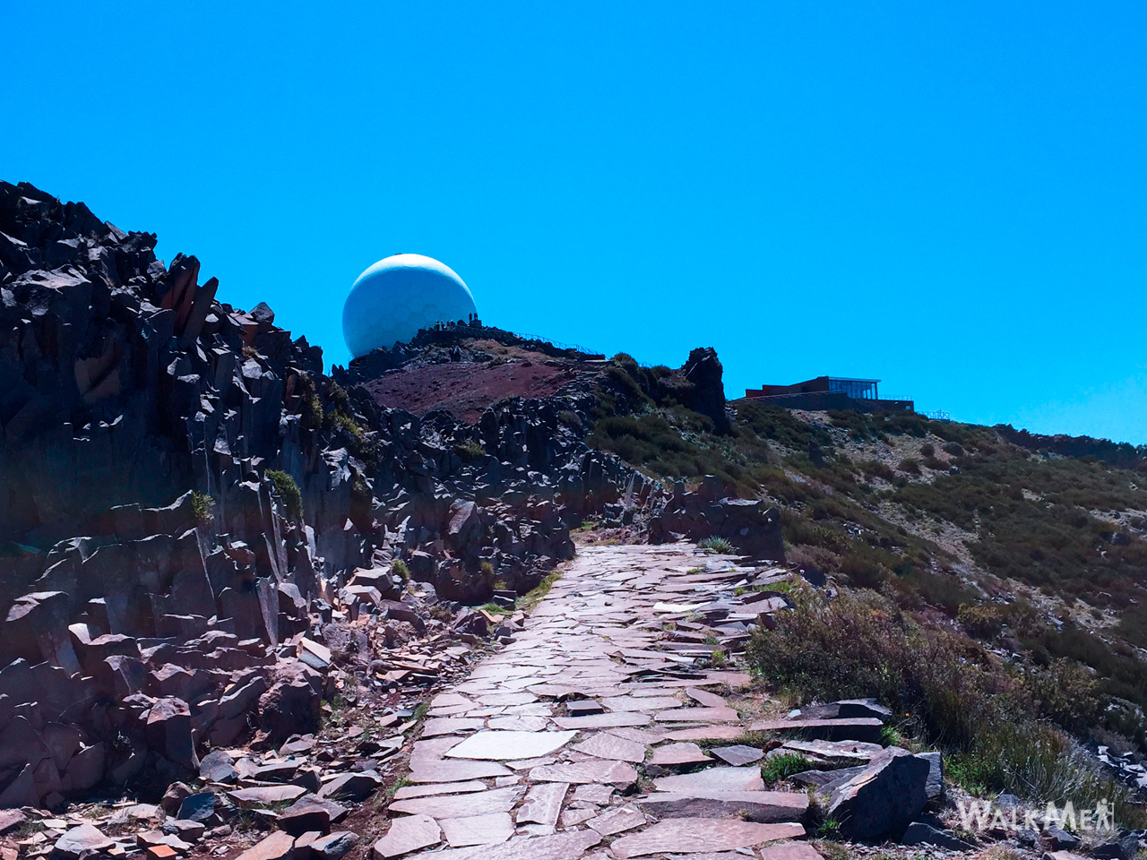
Vereda do Areeiro6 photos
Vereda do AreeiroVereda do AreeiroVereda do AreeiroVereda do AreeiroVereda do AreeiroVereda do Areeiro
Official PR trail (IFCN) Community route (AllTrails — not official)
Photos: walkmeguide.com · green = official IFCN PR trail · amber = community route (AllTrails)

Here's what you need to know about PR 1 – Vereda do Areeiro, one of Madeira's most iconic mountain trails:


PR 1 – Vereda do Areeiro

Route: Pico do Areeiro → Pico Ruivo
Official PR code: PR 1
Managing authority: IFCN (Institute of Forests and Nature Conservation)
Official page: VisitMadeira – PR 1 Vereda do Areeiro

Key facts
Distance6.1 km
Duration~3 h 30 min
DifficultyModerate (official) / Hard (hiker consensus)
StartPico do Areeiro Viewpoint (1,818 m)
EndPico Ruivo (1,862 m)
Highest point1,857 m
Lowest point1,491 m
Access fee€4.50 per visitor (over 12); under 12 free — pay via the SIMplifica portal
Parking€4.00/hour
The trail

This route takes you between two of Madeira's highest peaks — Pico do Areeiro (1,818 m) and Pico Ruivo (1,862 m) — through dramatic high-altitude terrain above the clouds. The path passes through tunnels carved into volcanic rock, along narrow ridgelines with jaw-dropping views into deep valleys, and across the island's rugged central massif. The route includes two variants:

  • Vereda Oeste (western route via tunnels) — the classic path through hand-carved rock tunnels
  • Vereda Este (eastern route via Pico das Torres) — currently closed (per the official route notes)

⚠️ Note on the eastern variant: The Pico das Torres route is listed as closed (Encerrado). Use the western tunnel route.

Community rating

4.6 / 5 from 4,384 hiker reviews on AllTrails — one of Madeira's most popular and highest-rated trails.

What to expect
  • Altitude: The entire trail sits above 1,490 m — expect rapid weather changes, cold winds, and low cloud. The difference between blue-sky views and thick fog can be minutes.
  • Terrain: Volcanic rock paths, hand-carved tunnels (bring a head torch/phone light), and some steep stair sections. Can be slippery after rain.
  • End point logistics: Pico Ruivo is also the terminus of PR 1.2 (from Achada do Teixeira) and PR 1.1 (from Ilha). Many hikers arrange a one-way car drop-off or taxi from Achada do Teixeira rather than returning the same way.
Getting to the trailhead

Directions to Pico do Areeiro ↗

There's also a live webcam at Pico do Areeiro so you can check conditions before you go: Pico do Areeiro webcam


⚠️ Before you go: Trail status changes — check the current open/closed status and any IPMA weather warnings for the mountain regions on openmadeira.org.Conditions above 1,500 m can shift fast; even on a sunny day in Funchal, the peaks can be foggy and cold.

Want me to check the mountain weather forecast and any weather warnings for the day you're planning to go?

OpenMadeira can make mistakes — check the sources.