OpenMadeira
Tell me about the PR 1 Vereda do Pico Branco e Terra Chã hike in Madeira
💭 Thinking
The user is asking about a specific hiking trail - PR 1 Vereda do Pico Branco e Terra Chã. I should use the find_hikes tool to get the official information about thistrail.I found the trail. Let me compile the information about PR 1 Vereda do Pico Branco e Terra Chã from the results. Key facts: - PR code: PR 1 - Name: Vereda do Pico Branco e Terra Chã - Region: Porto Santo - Official trail managed by IFCN - Route: ER 111 – Pico Branco - Terra Chã - Distance: 2.7 km (+ 2.7 km return) - Difficulty: Moderate (official), Hard (AllTrails community) - Duration: 1:30 hours (official) - Start point: ER 120 - End point: Terra Chã - Max altitude: 450 m - Min altitude: 184 m - Access fee: €4.50 for visitors > 12 years, exempt for visitors ≤ 12 years (via SIMplifica portal) - AllTrails rating: 4.8★ from 118 reviews - AllTrails estimated time: 2.5–3 hr - Route type: Out and back - Features: beach, views The note says this is an EVERGREEN trail guide and I should NOT state open/closed status since it's deliberately omitted. I should tell the reader to check the current trail status on OpenMadeira. Let me also get a video of this trail and check YouTube for a video.Now I have detailed information about the PR 1 Vereda do Pico Branco e Terra Chã trail. Let me compile all the key facts from the official sources and present them clearly. This trail is on Porto Santo island, not on Madeira island itself — it's important to note that. Key facts from the data: - **PR code:** PR 1 (Porto Santo) - **Name:** Vereda do Pico Branco e Terra Chã - **Region:** Porto Santo - **Managing entity:** IFCN - **Route:** ER 111 – Pico Branco - Terra Chã - **Distance:** 2.7 km (+ 2.7 km return) = 5.4 km round trip - **Difficulty:** Moderate - **Duration:** 1h30 (one way) - **Start point:** ER 120 (or ER 111 — sources mention both, IFCN data says ER 120, but other descriptions say ER 111. The official IFCN data says "ER 120" while visitmadeira says "ER 111". I notice the trilhos site says "Estrada Regional n.º 120" while others say "ER 111". Let me look more carefully... The IFCN data in find_hikes says start_point is "ER 120" and end_point is "Terra Chã". But other sources say ER 111. Looking at the road name — the regional road number may have different references. I'll report both or use what IFCN says since it's the official source.) - **End point:** Terra Chã - **Max altitude:** 450 m - **Min altitude:** 184 m - **Access fee:** €4.50 (Visitor > 12 years), exempt for ≤ 12 years, via SIMplifica - **AllTrails rating:** 4.8★ from 118 reviews — this is one of the top-rated hikes! - **Status:** The note says not to state open/closed status since it's an evergreen page, but the trilhos site says "percurso aberto" (open). I should advise checking the current status. Description highlights: - Originally a route for pack donkeys - Passes the impressive Rocha Quebrada prismatic rock formation - Climbs to the Cabeço do Caranguejo rock gap - Landscape shifts to cypress forest (Cupressus macrocarpa) - Trail forks: left to Pico Branco (second-highest peak on Porto Santo, 450m), right to Terra Chã - Part of the Natura 2000 network — richest area of preserved indigenous flora on Porto Santo - Terra Chã has a small house formerly used for endemic plant propagation and study - Numerous natural viewpoints along the way - No water sources along the trail — bring your own - The return is via the same path Let me write a comprehensive answer aboutthis trail.
How this was derived · 4 steps
Trails near Porto SantoMap & photos
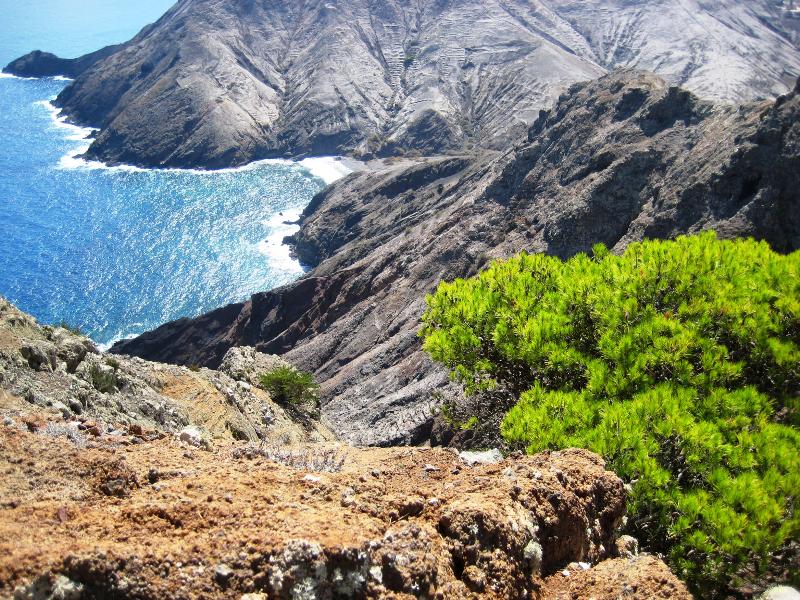
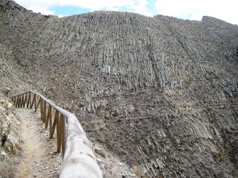
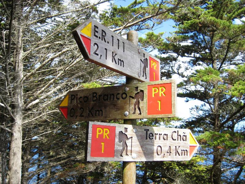
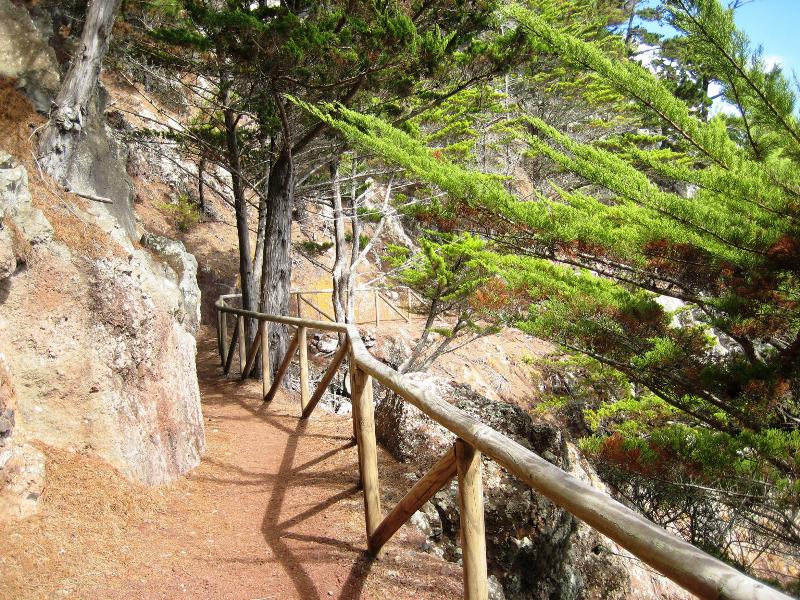
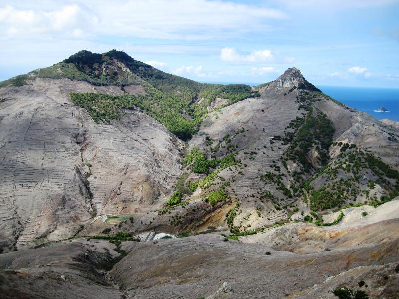
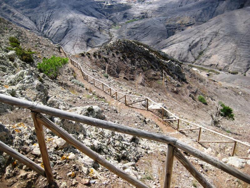
Vereda do Pico Branco e Terra Chã6 photos
Vereda do Pico Branco e Terra ChãVereda do Pico Branco e Terra ChãVereda do Pico Branco e Terra ChãVereda do Pico Branco e Terra ChãVereda do Pico Branco e Terra ChãVereda do Pico Branco e Terra Chã
Official PR trail (IFCN) Community route (AllTrails — not official)
Photos: walkmeguide.com · green = official IFCN PR trail · amber = community route (AllTrails)
PR 1 — Vereda do Pico Branco e Terra Chã

📍 Porto Santo · IFCN managed · Moderate · 4.8★ from 118 hiker reviews on AllTrails


At a glance
Distance2.7 km one way (5.4 km round trip)
Duration~1 h 30 min one way
DifficultyModerate
StartER 111 / ER 120 (Porto Santo)
EndTerra Chã
Altitude184 m → 450 m
TypeLinear (out & back)
Access fee€4.50 (visitors > 12 years; ≤ 12 free) via SIMplifica
Managing entityIFCN

Directions to trailhead ↗ · Official page (Visit Madeira)


The route

This is Porto Santo's signature hike — originally a track for loaded donkeys when locals sowed barley at Terra Chã, now a waymarked vereda through some of the island's most striking landscapes.

1. Rocha Quebrada — Right at the start you pass through an enormous prismatic basalt formation called Rocha Quebrada (Broken Rock), where the trail itself has been carved through the stone.

2. The climb to Cabeço do Caranguejo — After the initial gentle winding, the path steepens with uneven stone steps up to a gap in the rock called the Cabeço do Caranguejo. The arid terrain is exposed to sun — carry water, as there are no springs along the route.

3. Cypress forest — Beyond the gap, the landscape shifts dramatically to a shaded stretch of Monterey cypress (Cupressus macrocarpa), planted in the early 20th century to combat erosion. It feels almost Mediterranean.

4. The fork — You reach a signed junction:

  • Right → Terra Chã (400 m) — A plateau under a canopy of tall trees with a small study house for endemic plant propagation and several natural viewpoints overlooking dramatic cliffs and the Atlantic. The Green Island's most important refuge for indigenous flora.
  • Left → Pico Branco (200 m) — The island's second-highest peak at 450 m, named for its white stone column and the white lichens (Roccella sp.) growing on the rock, once exported for dye production. The summit offers sweeping 360° views over Porto Santo and the ocean.

5. Return — Same path back down.

Highlights
  • Natura 2000 site — The Pico Branco e Terra Chã area holds the best-preserved concentration of native flora on Porto Santo, including endemic species like Urtica portosanctana, Erysimum arbuscula, and Vicia costae.
  • Seabirds — Look for Cory's shearwater (Calonectris diomedea borealis) and common terns (Sterna hirundo) nesting in the cliffs.
  • Sunrise hike — The eastern-facing orientation makes this a fantastic sunrise walk on Porto Santo.
Practical tips
  • No water on the trail — bring enough for the full round trip, especially in summer.
  • Start early to avoid midday heat on the exposed sections.
  • Sturdy shoes with grip — the stone steps can be slippery.
  • Access fee of €4.50 per adult must be paid in advance via SIMplifica; children 12 and under are exempt.
  • Check current trail status before setting out — conditions can change due to weather or maintenance.

Photos: WalkMeGuide gallery


Want me to check the weather forecast for Porto Santo before you go, or look into how to get to Porto Santo (ferry schedule)?

OpenMadeira can make mistakes — check the sources.