💭 Thinking
How this was derived · 4 steps
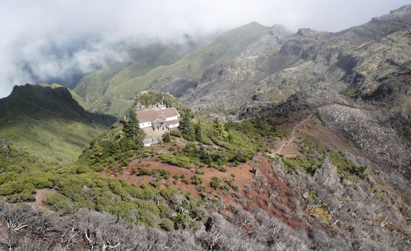


- Vereda da Ilha 4.6 Directions
Vereda da Ilha is an official PR trail on Madeira, managed by IFCN. It runs from the Casa de Abrigo do Pico Ruivo (the mountain shelter near Madeira's highest peak) downhill through spectacular mountain terrain to the village of Ilha, in the municipality of Santana.
| Official code | PR 1.1 |
| Route | Pico Ruivo → Ilha |
| Distance | 8.2 km |
| Official difficulty | Moderate |
| Estimated duration | ~3 hours |
| Start point | Casa de Abrigo do Pico Ruivo (1,764 m) |
| End point | Ilha (490 m) |
| Altitude range | 1,764 m → 490 m |
| Managed by | IFCN |
This trail requires a paid access pass via the SIMplifica portal:
- €4.50 — visitors over 12 years
- Free — visitors 12 years and under
4.6 ★ from 161 reviews on AllTrails — the community rates it as hard (due to the significant elevation loss and rugged terrain), and most hikers report it takes 7.5–8.5 hours round-trip. AllTrails page ↗
The trail descends dramatically from Pico Ruivo — Madeira's highest point at 1,862 m — through Laurisilva forest and exposed mountain ridgelines, ending down in the lush Ilha valley. The views across the central massif are outstanding, and the vegetation shifts from alpine heath to dense laurel forest as you lose altitude. It's a point-to-point trail, so you'll need to arrange transport at the far end or hike back up.
⚠️ Before you go, check the current trail status — open/closed conditions change with weather and maintenance. You can verify the latest status on OpenMadeira.
Directions to the trailhead ↗ — Google Maps will route you from wherever you are.
Photos: walkmeguide.com
Want me to check the mountain weather forecast and IPMA warnings for the day you're planning to hike, or look into how to get to Pico Ruivo by bus?