Tell me about the PR 3 Vereda do Burro hike in Madeira
💭 Thinking
The user is asking about the PR 3 Vereda do Burro hike in Madeira. I should use the find_hikes tool to get details about this specific trail.The result came back empty (count: 0, hikes: []). But wait - the note suggests this is an evergreen trail guide template. Let me look more carefully - actually, the result says count:0 and hikes:[]. This means no trail was found matching "PR 3 Vereda do Burro".
Hmm, but PR 3 is a real trail in Madeira. Let me try a different search approach - maybe searching with just "PR 3" or "Burro".I found the PR 3 Vereda do Burro trail. Let me compile the information from the results.
Key details:
- PR code: PR 3
- Name: Vereda do Burro
- Region: Madeira
- Difficulty: Easy (official IFCN rating), though AllTrails community rates it as "hard"
- Distance: 6.7 km
- Duration: 2:40 hours
- Start point: Pico do Areeiro
- End point: Ribeira das Cales - Funchal Ecological Park Welcome Centre
- Max altitude: 1805 m
- Min altitude: 1130 m
- Route: Pico do Areeiro – Ribeira das Cales
- Managing entity: Câmara Municipal do Funchal
- AllTrails: 4.6★ from 4,384 reviews
- Directions URL available
- Detail URL: https://visitmadeira.com/en/what-to-do/nature-seekers/activities/hiking/pr-3-vereda-do-burro/
The note says not to state open/closed/restricted status since it's evergreen, and to direct users to check current status. Let me also get current weather for the trail area since it's at high altitude.
Let me also find a video of this trail and check the weather since it starts at Pico do Areeiro (veryhigh altitude).Now I have comprehensive information about PR 3 Vereda do Burro. Let me compile the key facts:
From the tool results and web search:
1. **Official IFCN data** (from find_hikes):
- PR code: PR 3
- Name: Vereda do Burro
- Distance: 6.7 km (IFCN/visitmadeira) — some sources say 7.2 km
- Difficulty: Easy (official IFCN rating)
- Duration: 2:40 hours
- Start: Pico do Areeiro (1,805m)
- End: Ribeira das Cales - Funchal Ecological Park Welcome Centre
- Max altitude: 1,805m
- Min altitude: 1,130m
- Route: Pico do Areeiro – Ribeira das Cales
- Managing entity: Câmara Municipal do Funchal
- Community rating: 4.6★ from 4,384 reviews on AllTrails
2. **Current status**: CLOSED (from madeirahiking.org, a trusted source)
- The trail is currently closed
3. **Key highlights** (from visitmadeira.com and other sources):
- Poço da Neve (1813 ice house/snow well) — an igloo-shaped reservoir built in 1813
- High-altitude endemic flora (Sorbus maderensis, Erica platycodon, Erica arborea, Vaccinium padifolium, Ilex perado, Laurus novocanariensis)
- Valley views of Ribeira do Cidrão
- Views of the western mountain massif and Paul da Serra plateau
- Birds: Atlantic canary (bis-bis, Regulus madeirensis) and Berthelot's pipit (corre-caminhos, Anthus berthelotii madeirensis)
4. **Access/fees**: €4.50 (€3 with protocol operator) via SIMplifica when open
5. **Safety notes**: High altitude start (1,805m) — can be 10-15°C cooler than Funchal; cold and windy conditions common; fog and rain can appear rapidly above 1,000m
6. **Trail type**: Vereda (mountain descent) — mostly downhill
7. **Elevation drop**: ~675m descent
The user is writing in English, so I'll answer in English.
Important: The trail is currently CLOSED. I need to lead with that.
Let me also note the discrepancy in distance: IFCN says 6.7 km, other sources (visitmadeira.com and madeirahiking.org) say 7.2 km. I'll use the IFCN figure since that's the official source but mention it.
Actually, looking more carefully at the data:
- find_hikes returned: distance "6,7 km" which includes the IFCN data
- The visitmadeira.com page and other sources say 7.2 km
- The madeirahiking.org also says 7.2 km
I'll use 6.7 km from the IFCN data as the primary figure, but the VisitMadeira and other sources say 7.2. Let me use the IFCN figure as it's the official source.
Wait, actually looking more carefully at the find_hikes result, it says distance "6,7 km" — that's what I should use as it's from IFCN. But the general description sources say 7.2 km. I'll mention both but lead with the official IFCN figure.
Actually, let me re-read: the IFCN data from the tool says 6.7 km. The visitmadeira.com description page says 7.2 km in the route description. There might be a variant difference. I'll use the official IFCN figure.
Let me compose the answer.
How this was derived · 6 steps
TrailsMap & photos
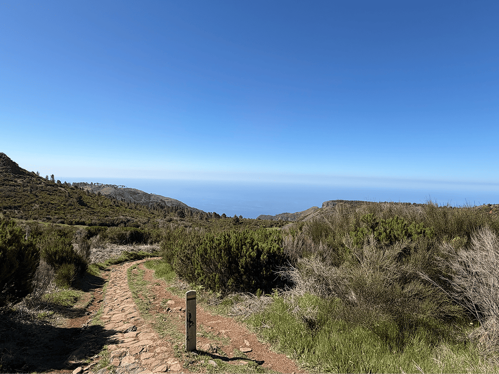
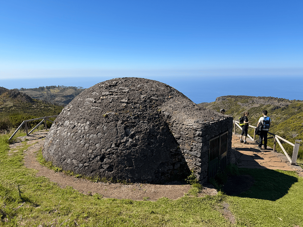
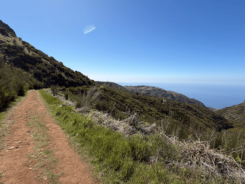
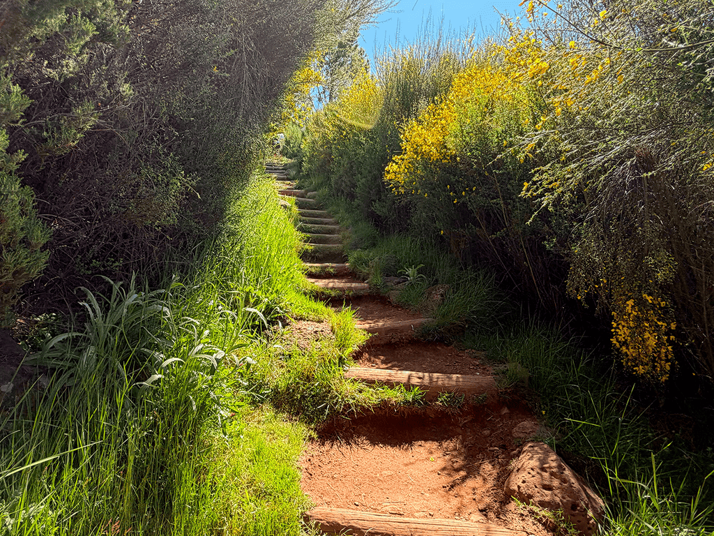
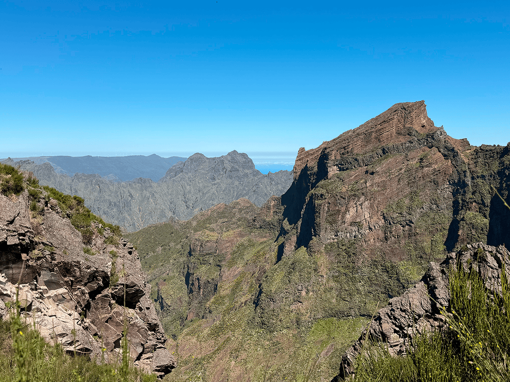
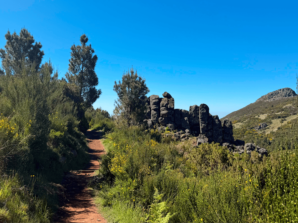
Official PR trail (IFCN) Community route (AllTrails — not official)
- Vereda do Burro 4.6 Directions
Photos: walkmeguide.com · green = official IFCN PR trail · amber = community route (AllTrails)
PR 3 — Vereda do Burro
⚠️ Currently CLOSED — this trail is not open for hiking right now. Check the official IFCN status page or OpenMadeira for reopening updates.
Quick facts
| Difficulty | Easy (official rating) |
| Distance | 6.7 km (linear) |
| Duration | ~2 h 40 min |
| Trail type | Vereda (mountain descent) |
| Start | Pico do Areeiro (1,805 m) |
| End | Ribeira das Cales — Funchal Ecological Park (1,130 m) |
| Altitude range | 1,805 m → 1,130 m (~675 m descent) |
| Managed by | Câmara Municipal do Funchal |
| Access fee (when open) | €4.50 via SIMplifica (€3 with a protocol operator) |
| Community rating | 4.6★ from 4,384 reviews on AllTrails |
What makes it special
Starting just below the summit of Pico do Areeiro — Madeira's third-highest peak at 1,818 m — the trail descends through the island's high-altitude zone towards the Funchal Ecological Park. The highlights:
- Poço da Neve (~1.7 km from the start) — An igloo-shaped ice house dating from 1813, once used to store snow and hail from the peaks. The ice was carried downhill to Funchal's hospitals, hotels and gelato makers until the arrival of mechanical freezers in the early 20th century.
- Ribeira do Cidrão valley views — Sweeping panoramas over one of Madeira's deepest valleys, which meets the Ribeira dos Socorridos at Curral das Freiras.
- High-altitude endemic flora — Along the route you'll find rare Madeiran sorbus (Sorbus maderensis), heaths (Erica platycodon, Erica arborea), blueberry (Vaccinium padifolium), Madeiran holly (Ilex perado) and laurel (Laurus novocanariensis).
- Endemic birds — Firecrest (bis-bis, Regulus madeirensis) and Berthelot's pipit (corre-caminhos, Anthus berthelotii madeirensis) are commonly spotted.
Practical notes (for when it reopens)
- It's almost all downhill — easy on lungs, hard on knees. Trekking poles are recommended.
- High-altitude start — at 1,805 m the temperature can be 10–15 °C colder than Funchal, and wind, fog and rain can roll in fast. Always check the mountain forecast and IPMA warnings before heading up.
- No tunnels on this route.
- Getting to the start — Pico do Areeiro car park; organise a taxi or second car for the one-way route (you finish at the Ecological Park, not back at the start).
Sources — Visit Madeira · IFCN trail register · Trail status & fees · Madeira Friends Blog
Would you like me to suggest an open alternative nearby — or check the mountain weather forecast for the day you're planning to hike?
OpenMadeira can make mistakes — check the sources.