OpenMadeira
Tell me about the PR 3.1 Caminho Real do Monte hike in Madeira
💭 Thinking
The user is asking about a specific hiking trail - PR 3.1 Caminho Real do Monte in Madeira. I should use the find_hikes tool to get the official information about this trail.The find_hikes tool returned 0 results for "PR 3.1 Caminho Real do Monte". Let me try a broader search with just "PR 3" or "Caminho Real do Monte".I have the trail details for PR 3.1 Caminho Real do Monte. Let me compile the information: - PR code: PR 3.1 - Name: Caminho Real do Monte - Region: Madeira - Managing entity: Câmara Municipal do Funchal - Route: Ribeira das Cales – Monte - Distance: 5.5 km - Difficulty: Moderate - Duration: 2 hours - Start point: Ribeira das Cales - Funchal Ecological Park Welcome Centre - End point: Monte - Max altitude: 1,130 m - Min altitude: 550 m - Directions URL available The status field is empty in this evergreen context, so I should not state a specific status. Instead, I'll tell the reader to check the current status. Let me also get some more context about the trail description - I could look at the visitmadeira page for a richer description. Actually, the result doesn't include a description field. Let me check if I should use web_lookup or read_url to get more details from the visitmadeira page. Actually, let me fetch the visitmadeira page for a better description ofthe trail.I now have all the information I need about the PR 3.1 Caminho Real do Monte hike. Let me compile a comprehensive answer. Key details: - PR code: PR 3.1 - Name: Caminho Real do Monte - Region: Madeira - Managing entity: Câmara Municipal do Funchal - Distance: 5.5 km (from IFCN data) / 4.2 km (from VisitMadeira) — I'll use the official IFCN figure of 5.5 km - Difficulty: Moderate - Duration: ~2 hours - Start point: Ribeira das Cales - Funchal Ecological Park Welcome Centre - End point: Monte - Max altitude: 1,130 m - Min altitude: 550 m - Route: Ribeira das Cales – Monte - Highlights: Levada das Cales (1784), indigenous/exotic vegetation, panoramic views from Pico Alto viewpoint at 1,129 m, Monte Palace Madeira garden, Mother Church, traditional wicker sledges at Monte The note says I should NOT state any open/closed/restricted status for this evergreen page and should tell the reader to check the current status on OpenMadeira. Let me compose the answer accordingly. Actually, re-reading the instructions: "Do NOT state any open/closed/restricted status — it is DELIBERATELY omitted here because this page is cached." So I should not claim a specific status but direct the user to check the current status. Let me write a comprehensive answer about thistrail.
How this was derived · 4 steps
TrailsMap & photos
Caminho Real do Monte6 photos
Caminho Real do MonteCaminho Real do MonteCaminho Real do MonteCaminho Real do MonteCaminho Real do MonteCaminho Real do Monte
Official PR trail (IFCN) Community route (AllTrails — not official)
Photos: walkmeguide.com · green = official IFCN PR trail · amber = community route (AllTrails)
PR 3.1 — Caminho Real do Monte

Moderate · 5.5 km · ~2 hours · Managed by Câmara Municipal do Funchal

The Caminho Real do Monte ("Royal Path of Monte") is one of Funchal's most rewarding hikes — a route that weaves from the lush heights of the Funchal Ecological Park down to the historic parish of Monte, combining levada paths, panoramic viewpoints, and cultural landmarks in a single walk.


The route
  • Start: Ribeira das Cales — Funchal Ecological Park Welcome Centre
  • End: Monte
  • Altitude range: 550 m → 1,130 m (max)
  • Route key points: Ribeira das Cales → Levada das Cales → Pico Alto viewpoint → Monte

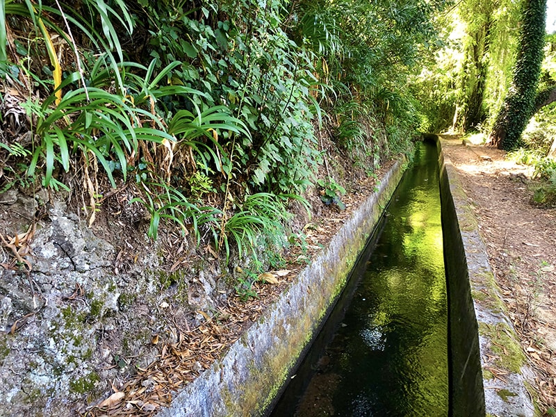
The trail follows the Levada das Cales, an irrigation canal dating back to 1784, threading through indigenous and exotic vegetation. The highlight along the way is the Pico Alto viewpoint at 1,129 m, offering sweeping panoramic views over Funchal and the south coast. The path then descends into the parish of Monte, where you pass the Mother Church and the renowned Monte Palace Madeira tropical garden.


Practical info
DifficultyModerate
Distance5.5 km
Duration~2 hours
Managing entityCâmara Municipal do Funchal

⚠️ Trail status changes — Before heading out, check the current open/closed/restricted status of this trail on OpenMadeira or the official IFCN page, as conditions can change due to maintenance or weather.


Getting there & back
  • To the start: The trailhead is at the Funchal Ecological Park Welcome Centre (Ribeira das Cales). Directions ↗
  • From the end: Monte is well connected — you can ride the famous wicker toboggan sledges back down toward Funchal, take the Funchal cable car (teleférico) from Monte to the waterfront, or catch a local bus.

Highlights along the way
  • 🌿 Levada das Cales — a historic 1784 water channel shaded by laurel and exotic trees
  • 🏔️ Pico Alto viewpoint (1,129 m) — panoramic views over Funchal and the Atlantic
  • Monte parish — the Mother Church and the Monte Palace garden mark the end of the walk
  • 🛷 Wicker toboggan ride — a unique way to descend from Monte back toward Funchal

Read more on VisitMadeira ↗ · Photos from walkmeguide.com

Would you like me to check the mountain weather forecast and IPMA warnings for the day you're planning to hike, so you can go safely?

OpenMadeira can make mistakes — check the sources.