OpenMadeira
Tell me about the PR 4 Levada do Barreiro levada walk in Madeira
💭 Thinking
The user is asking about PR 4 Levada do Barreiro in Madeira. This is a hiking trail question, so I should use the find_hikes tool with the query "PR 4" to get official information about this trail.The search returned 0 results. Let me try a broader search or different query format.I found the trail PR 4 Levada do Barreiro. Let me summarize the key information: - PR code: PR 4 - Name: Levada do Barreiro - Region: Madeira - Managing entity: Câmara Municipal do Funchal - Route: Poço da Neve – Casa do Barreiro - Distance: 6.7 km - Difficulty: Easy (official) - Duration: 2:10 hours - Start point: Poço da Neve - End point: Casa do Barreiro - Max altitude: 1650 m - Min altitude: 975 m - AllTrails rating: 4.6★ from 4384 reviews - Directions URL available The note says I should NOT state any open/closed/restricted status since it's deliberately omitted, and tell the reader to check the current status on OpenMadeira. Let me also find a video of this trail to offer as a follow-up.
How this was derived · 3 steps
TrailsMap & photos
Levada do Barreiro6 photos
Levada do BarreiroLevada do BarreiroLevada do BarreiroLevada do BarreiroLevada do BarreiroLevada do Barreiro
Official PR trail (IFCN) Community route (AllTrails — not official)
Photos: walkmeguide.com · green = official IFCN PR trail · amber = community route (AllTrails)
PR 4 — Levada do Barreiro

PR 4 Levada do Barreiro is an officially recommended levada walk managed by the Câmara Municipal do Funchal. Here are the key details:

RoutePoço da Neve → Casa do Barreiro
Distance6.7 km
DifficultyEasy
Duration~2 h 10 min
Max altitude1,650 m
Min altitude975 m

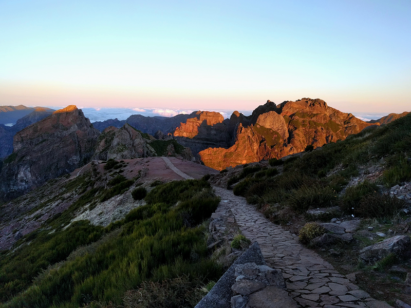
The trail starts at Poço da Neve — one of the highest points on the island — and follows the levada downhill through laurel forest and open mountain slopes to Casa do Barreiro. At those altitudes you're above the tree line at the start, with sweeping panoramic views across the central massif, then descend gradually into greener, more sheltered terrain. It's a lovely walk for catching the contrast between Madeira's high mountain scenery and its lush water-channel paths.

4.6 / 5 from 4,384 hiker reviews on AllTrails — one of the island's most popular trails.

Getting to the trailhead: Directions ↗ (routes from wherever you are).

ℹ️ Trail status changes — check the current open/closed status on OpenMadeira before setting out, especially at this altitude where weather can shift quickly.

Would you like me to check the mountain forecast and IPMA weather warnings for the day you plan to go, or show you a video of the trail?

OpenMadeira can make mistakes — check the sources.