💭 Thinking
How this was derived · 3 steps
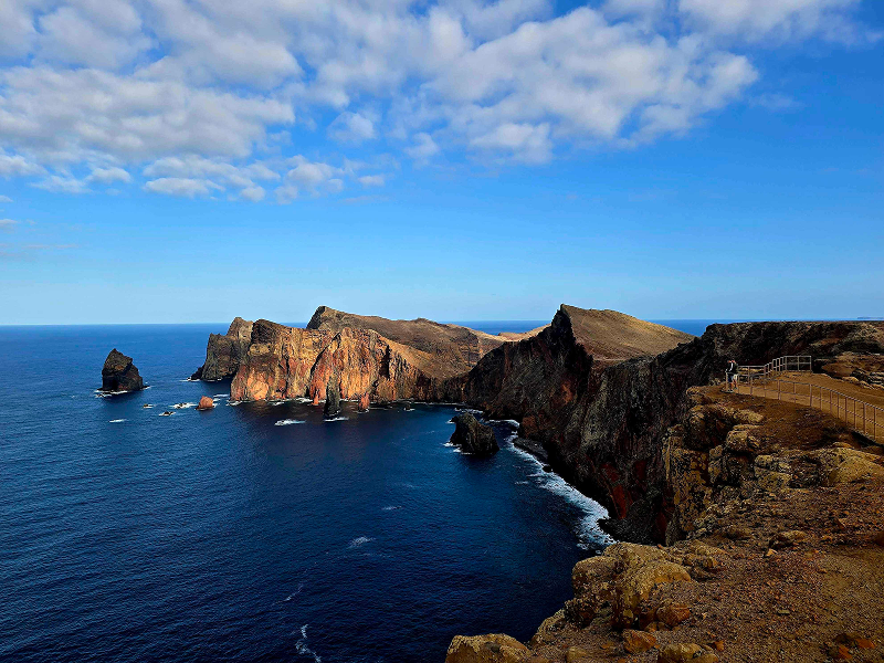


- Vereda da Ponta de S. Lourenço 4.7 Directions
One of Madeira's most iconic hikes, PR 8 takes you along the dramatic easternmost peninsula of the island — a landscape that feels like another world, with sheer ochre cliffs dropping into sapphire Atlantic waters, and vegetation unlike the lush laurel forests elsewhere on Madeira.
| Route | Baía D'Abra → Cais do Sardinha (out & back) |
| Distance | 4 km one way (+ 4 km return) — 8 km total |
| Difficulty | Moderate |
| Duration | ~2 h 30 min |
| Start point | Baía d'Abra |
| End point | Casa do Sardinha |
| Max / min altitude | 126 m / 23 m |
| Managed by | IFCN |
⚠️ There's an entry fee payable via the SIMplifica portal before you go:
- €4.50 — visitors over 12 years
- Free — children 12 and under
The trail runs along the Ponta de São Lourenço peninsula, Madeira's easternmost point. You'll walk between the north and south coasts simultaneously, with jaw-dropping cliff-edge views on both sides. The landscape is arid and volcanic — all rust-coloured rock, sculpted formations, and low-lying vegetation — a total contrast to the green levadas in the centre of the island.
The route passes several viewpoints before reaching Casa do Sardinha at the far end, where a natural pool offers a tempting dip on a hot day (if the sea is calm). Look out for the Caniçal webcam (live view) to check conditions before you go.
⭐ 4.7 / 5 from 7,989 hiker reviews on AllTrails — one of the highest-rated and most popular trails on the island.
Before setting out, check the current trail status on OpenMadeira — conditions change (rockfalls, maintenance closures) and the online status is updated regularly by IFCN.
Would you like me to check the mountain weather forecast and IPMA warnings for the day you're planning to hike, or look into how to get there by bus?