💭 Thinking
How this was derived · 4 steps
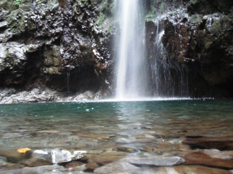


- Levada do Caldeirão Verde 4.6 Directions
One of Madeira's most iconic levada walks, PR 9 takes you through the lush laurel forest of Santana to the spectacular Caldeirão Verde waterfall and onwards to the dramatic Caldeirão do Inferno canyon.
| Official code | PR 9 |
| Route | Queimadas → Caldeirão Verde → Caldeirão do Inferno |
| Type | Out-and-back |
| Distance | 8.7 km each way (≈ 17.4 km total) |
| Duration | ~6 h 30 min |
| Difficulty | Moderate |
| Altitude | 872 m – 1 020 m |
| Start | Queimadas Forest Park (Santana) |
| End | Caldeirão do Inferno |
| Managed by | IFCN (regional forests & nature authority) |
Payment via the SIMplifica portal is required:
- €4.50 — visitors > 12 years
- Free — visitors ≤ 12 years
- Parking — €2.00/hour
The trail begins at the Queimadas Forest Park, where you'll find the charming Casinhas de Santana — traditional thatched-roof shelter houses that reflect Santana's vernacular architecture. The park itself is worth exploring, planted with cryptomeria, European beech, Madeira cedar, and native trees like til and pau-branco.
From Queimadas, you follow the Levada do Caldeirão Verde — an 18th-century irrigation channel carved into the mountainside. The path hugs the levada through dense laurisilva (Madeira's ancient laurel forest, a UNESCO World Heritage Site), passing through several rock-cut tunnels and crossing steep, moss-covered slopes. A torch/flashlight is essential for the tunnels.
The first key highlight is Caldeirão Verde ("Green Cauldron") — a stunning waterfall plunging into a deep emerald pool, surrounded by towering green walls. Further along (and worth the extra effort), the trail continues to Caldeirão do Inferno ("Hell's Cauldron"), an even more dramatic and wild canyon — the official endpoint.
You return the same way.
⭐ 4.6/5 from 4,562 hiker reviews on AllTrails — one of the most popular and highest-rated trails on the island.
If you want a shorter, easier walk to the same area, PR 9.1 "Um Caminho para Todos" (A Path for Everyone) is a 1.9 km accessible trail in the Queimadas Forest Park — ideal for families or those wanting a gentler introduction to the area.
- Check the current trail status on openmadeira.org before setting out — conditions can change (especially after heavy rain or rockfalls).
- Bring a torch for the tunnels.
- Wear proper hiking boots — the path can be wet and slippery.
- The trail is in the mountains; weather can shift quickly — check the mountain forecast and IPMA warnings for the Santana area.
Would you like me to check the weather forecast & IPMA warnings for the day you're planning to go, or help you find how to get to Queimadas by bus?