OpenMadeira
Tell me about the Ribeira Funda Viewpoint - Rocha dos Ingleses - Lagoa do Fanal hike in Madeira
💭 Thinking
The user is asking about a specific hike in Madeira: "Ribeira Funda Viewpoint - Rocha dos Ingleses - Lagoa do Fanal". Let me search for this trail using the find_hikes tool, and also look for curated videos of thearea.The user asked about "Ribeira Funda Viewpoint - Rocha dos Ingleses - Lagoa do Fanal" hike. I found it in the community_trails list — it's NOT an official IFCN PR trail, but a community route mapped on AllTrails. Let me present the details from the data. Key facts: - Name: Ribeira Funda Viewpoint - Rocha dos Ingleses - Lagoa do Fanal - Not an official PR trail — community route on AllTrails - Rating: 4.5★ from 346 reviews - Difficulty: Easy - Length: 3.4 km (loop) - Estimated time: 1–1.5 hr - Area: Madeira Natural Park - Location: Near Fanal, in the Laurissilva forest (UNESCO World Heritage) - Description highlights: viewpoint over Ribeira Funda, Lagoa do Fanal, green landscapes, fresh air, outdoor leisure activities - No official open/closed status (since it's not an IFCN trail) - Directions URL available - AllTrails URL available I should also mention the nearby official PR trails for context, since this is in the Fanal area. The closest official trail is PR 14 Levada dos Cedros (just 0.4 km / 2 min drive from Fanal). Let me also find a video or images for this trail.The user asked about the "Ribeira Funda Viewpoint - Rocha dos Ingleses - Lagoa do Fanal" hike. I found it in the community trails section - it's NOT an official IFCN PR trail, but a community route mapped on AllTrails. Let me compile the details from the data. Key details: - Name: Ribeira Funda Viewpoint - Rocha dos Ingleses - Lagoa do Fanal - It's a community/unofficial route (NOT part of Madeira's official PR trail network) - Rating: 4.5★ from 346 reviews on AllTrails - Difficulty: Easy - Length: 3.4 km - Route type: Loop - Estimated time: 1–1.5 hr - Area: Madeira Natural Park - Location: near Fanal, in the Laurissilva forest (UNESCO World Heritage) - Coordinates: 32.80907, -17.14158 Description highlights: - Crosses an area of Laurissilva forest classified as World Natural Heritage by UNESCO (since December 1999) - Part of the European Network of Sites of Community Importance - Natura 2000 Network - Highlights: viewpoint over Ribeira Funda, Lagoa do Fanal, beautiful green landscapes, fresh air I should present this clearly, with the important caveat that it's a community route, not an official IFCN PRtrail.
How this was derived · 2 steps
Trails near FanalMap & photos
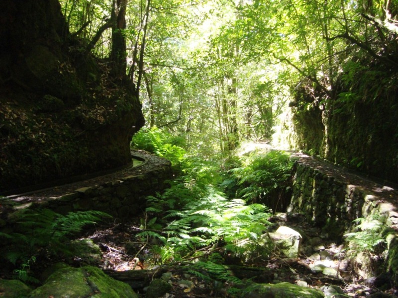
Levada dos Cedros6 photos
Levada dos CedrosLevada dos CedrosLevada dos CedrosLevada dos CedrosLevada dos CedrosLevada dos Cedros
Official PR trail (IFCN) Community route (AllTrails — not official)
Photos: walkmeguide.com · green = official IFCN PR trail · amber = community route (AllTrails)
Ribeira Funda Viewpoint – Rocha dos Ingleses – Lagoa do Fanal

This is a community route mapped on AllTrails — it is not part of Madeira's official PR (Percurso Recomendado) trail network managed by IFCN (the regional government's forests & nature-conservation authority), so it has no official open/closed status and no maintenance or signage guarantee. Check access and conditions locally before going.

TypeLoop
Distance3.4 km
DifficultyEasy
Estimated time1–1.5 hr
AreaMadeira Natural Park (Fanal)
Community rating★ 4.5 from 346 hiker reviews on AllTrails
What to expect

The trail crosses a remarkable section of the Laurissilva forest — Madeira's ancient laurel woodland classified as a UNESCO World Natural Heritage site since December 1999 and part of the Natura 2000 Network of Sites of Community Importance.

Along the route, the highlights are:

  • Miradouro sobre a Ribeira Funda — a viewpoint overlooking the deep Ribeira Funda valley
  • Rocha dos Ingleses — a striking rock formation
  • Lagoa do Fanal — the seasonal lagoon that gives the Fanal area its name, surrounded by centuries-old Til trees draped in moss
  • Beautiful green landscapes and fresh mountain air, inviting you to enjoy outdoor leisure activities

The area is known for its mystical, fog-shrouded atmosphere — on misty days the twisted, moss-covered trees create an almost otherworldly scene, while clear days open up sweeping views over the valleys and mountains.

Getting to the trailhead

📍 Approximate trailhead coordinates: 32.80907, -17.14158 (near Fanal, on the Paúl da Serra plateau)

Directions to trailhead ↗

Important notes
  • No official status — this is a community-mapped route, not an IFCN-recommended PR trail. There is no official open/closed status to check; verify locally before setting out.
  • Nearby official trails — the closest official PR trail is PR 14 Levada dos Cedros (just ~0.4 km from Fanal), which does have an official status and requires a €4.50 access fee via the SIMplifica portal (free for children ≤ 12 years).
  • The Fanal area is at roughly 1,000–1,100 m altitude — weather can change rapidly and fog rolls in quickly. Dress in layers and bring rain gear.

Would you like me to check the mountain weather forecast and IPMA warnings for the Fanal area, or show you the closest official PR trails in the area?

OpenMadeira can make mistakes — check the sources.